Florida's 12th congressional district
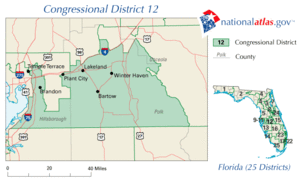
Florida's 12th congressional district is an electoral district for the U.S. Congress and was reassigned in 2012, effective January 2013, along the Gulf coast of central Florida. The district includes New Port Richey north of Tampa. It covers Pasco County and parts of north Pinellas County and Hillsborough County.[1][2]
The district is currently represented by Republican Gus Bilirakis.
List of representatives
The following list includes the names of the former representatives of the 12th congressional district, who are elected for 2-year terms, but can be re-elected to serve multiple terms.
| Representative |
Party |
Years |
District home |
Notes |
| District created January 3, 1963 |
 William C. Cramer William C. Cramer |
Republican |
January 3, 1963 – January 3, 1967 |
|
Redistricted from the
1st district, Redistricted to the
8th district |
 Dante Fascell Dante Fascell |
Democratic |
January 3, 1967 – January 3, 1973 |
|
Redistricted from the
4th district, Redistricted to the
15th district |
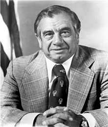
 J. Herbert Burke J. Herbert Burke |
Republican |
January 3, 1973 – January 3, 1979 |
|
Redistricted from the
10th district |
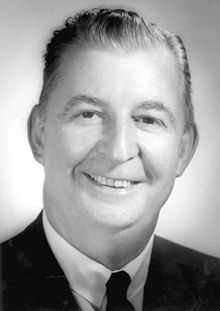
 Edward J. Stack Edward J. Stack |
Democratic |
January 3, 1979 – January 3, 1981 |
|
|
 E. Clay Shaw, Jr. E. Clay Shaw, Jr. |
Republican |
January 3, 1981 – January 3, 1983 |
|
Redistricted to the
15th district |
 Tom Lewis Tom Lewis |
Republican |
January 3, 1983 – January 3, 1993 |
|
Redistricted to the
16th district |
 Charles T. Canady Charles T. Canady |
Republican |
January 3, 1993 – January 3, 2001 |
|
|
 Adam Putnam Adam Putnam |
Republican |
January 3, 2001 – January 3, 2011 |
|
|
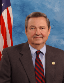
 Dennis A. Ross Dennis A. Ross |
Republican |
January 3, 2011 - January 3, 2013 |
|
Redistricted to the
15th district |
 Gus Bilirakis Gus Bilirakis |
Republican |
January 3, 2013 - present |
|
Redistricted from the
9th district |
Presidential Voting History
Election Results
2002
| Florida's 12th Congressional District Election (2002) |
| Party |
Candidate |
Votes |
% |
|
Republican |
Adam Putnam* |
' |
100.00 |
| Total votes |
' |
100.00 |
| Voter turnout |
% |
|
Republican hold |
2004
| Florida's 12th Congressional District Election (2004) |
| Party |
Candidate |
Votes |
% |
|
Republican |
Adam Putnam* |
179,204 |
64.89 |
|
Democratic |
Bob Hagenmaier |
96,965 |
35.11 |
| Total votes |
276,169 |
100.00 |
| Voter turnout |
% |
|
Republican hold |
2006
| Florida's 12th Congressional District Election (2006) |
| Party |
Candidate |
Votes |
% |
|
Republican |
Adam Putnam* |
124,452 |
69.12 |
|
Independent |
Joe Viscusi |
34,976 |
19.42 |
|
Independent |
Ed Bowlin |
20,636 |
11.46 |
| Total votes |
180,064 |
100.00 |
| Voter turnout |
% |
|
Republican hold |
2008
| Florida's 12th Congressional District Election (2008) |
| Party |
Candidate |
Votes |
% |
|
Republican |
Adam Putnam* |
185,698 |
57.46 |
|
Democratic |
Doug Tudor |
137,465 |
42.54 |
| Total votes |
323,163 |
100.00 |
| Voter turnout |
% |
|
Republican hold |
2010
| Florida's 12th Congressional District Election (2010) |
| Party |
Candidate |
Votes |
% |
|
Republican |
Dennis A. Ross* |
102,704 |
48.14 |
|
Democratic |
Lori Edwards |
87,769 |
41.14 |
|
Independent |
Randy Wilkinson |
22,857 |
10.71 |
| Total votes |
213,330 |
100.00 |
| Voter turnout |
% |
|
Republican hold |
- NOTE: Randy Wilkinson ran on the Tea Party platform on the ballot.
Historical district boundaries
The former 12th district, during 2003–2012, covered areas further east and encompassed much of Polk County as well as parts of rural and suburban east Hillsborough County and a small piece of western Osceola County, which became the center of the 9th district.

2003 - 2013 Former 12th district, centered at
Polk County.
References
- ↑ See whole Florida state map for 2013, with the 12th district covering
Pasco County and counties below:
h9047_35x42L.pdf
Congressional Plan: H000C9047. Chapter No. 2012-2, Laws of Florida.
www.flsenate.gov. February 16, 2012.
- ↑ See the 2013 boundaries of the 12th district, covering
Pasco County and northern
Pinellas County and northwest
Hillsborough in the 2013 districts map:
H000C9047_map_sw.pdf,
for the southwest region of Florida.
Congressional Plan: H000C9047. Chapter No. 2012-2, Laws of Florida.
www.flsenate.gov. February 2012.
Coordinates: 28°16′07″N 82°29′30″W / 28.26861°N 82.49167°W / 28.26861; -82.49167
.tif.png)
 William C. Cramer
 Dante Fascell
 J. Herbert Burke
 Edward J. Stack
 E. Clay Shaw, Jr.
 Tom Lewis
 Charles T. Canady
 Adam Putnam
 Dennis A. Ross
 Gus Bilirakis