Florenville
| Florenville | ||
|---|---|---|
| Municipality | ||
|
Church of Our Lady of the Assumption | ||
| ||
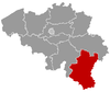
 Florenville Location in Belgium | ||
|
Location of Florenville in Luxembourg province 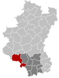 | ||
| Coordinates: 49°41.9′N 5°18.6′E / 49.6983°N 5.3100°ECoordinates: 49°41.9′N 5°18.6′E / 49.6983°N 5.3100°E | ||
| Country | Belgium | |
| Community | French Community | |
| Region | Wallonia | |
| Province | Luxembourg | |
| Arrondissement | Virton | |
| Government | ||
| • Mayor | Richard Lambert (cdH) | |
| • Governing party/ies | cdH, PS | |
| Area | ||
| • Total | 146.91 km2 (56.72 sq mi) | |
| Population (1 January 2013)[1] | ||
| • Total | 5,512 | |
| • Density | 38/km2 (97/sq mi) | |
| Postal codes | 6820-6824 | |
| Area codes | 061 | |
| Website | www.florenville.be | |

.svg.png)
Florenville is a Walloon municipality located in the Belgian province of Luxembourg. On 1 January 2007 the municipality had 5,448 inhabitants. The total area is 146.91 km², giving a population density of 37.1 inhabitants per km².
It is located on the Semois River, facing the French border.
Apart from Florenville itself, the municipality also contains the sections of Chassepierre, Fontenoille, Lacuisine, Muno, Sainte-Cécile and Villers-devant-Orval.
Orval Abbey is located in Villers-devant-Orval. Nearby is the citadel of Godfrey de Bouillon.
References
- ↑ Population per municipality on 1 January 2013 (XLS; 607.5 KB)
External links
- Florenville official website (French)
| Wikimedia Commons has media related to Florenville. |
| ||||||||||||||||||||||||