Fishing Creek Township, Columbia County, Pennsylvania
| Fishing Creek Township, Pennsylvania | |
|---|---|
| Township | |
|
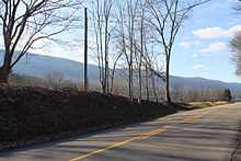
View of Fishing Creek Township in early winter | |
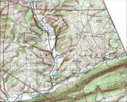 USGS map of Fishing Creek township | |
 Map of Columbia County, Pennsylvania | |
| Country | United States |
| State | Pennsylvania |
| County | Columbia |
| Settled | 1783 |
| Incorporated | 1789 |
| Area | |
| • Total | 28.5 sq mi (73.9 km2) |
| Population (2000) | |
| • Total | 1,393 |
| • Density | 48.8/sq mi (18.9/km2) |
| Time zone | Eastern (EST) (UTC-5) |
| • Summer (DST) | EDT (UTC-4) |
| Area code(s) | 570 |

Fishing Creek Township is a township in Columbia County, Pennsylvania, United States. The population was 1,393 at the 2000 census.
History
The Josiah Hess Covered Bridge No. 122, Twin Bridges-East Paden Covered Bridge No. 120, and Twin Bridges-West Paden Covered Bridge No. 121 were listed on the National Register of Historic Places in 1979. The Bridge in Fishing Creek Township was listed in 1988.[1]
Geography

According to the United States Census Bureau, the township has a total area of 28.5 square miles (74 km2), of which, 28.5 square miles (74 km2) of it is land and 0.04% is water.
Demographics
As of the census[2] of 2000, there were 1,393 people, 556 households, and 425 families residing in the township. The population density was 48.8 people per square mile (18.9/km²). There were 711 housing units at an average density of 24.9/sq mi (9.6/km²). The racial makeup of the township was 99.21% White, 0.14% Asian, 0.14% from other races, and 0.50% from two or more races. Hispanic or Latino of any race were 0.79% of the population.
There were 556 households out of which 29.0% had children under the age of 18 living with them, 66.4% were married couples living together, 7.0% had a female householder with no husband present, and 23.4% were non-families. 20.1% of all households were made up of individuals and 8.5% had someone living alone who was 65 years of age or older. The average household size was 2.51 and the average family size was 2.88.
In the township the population was spread out with 22.3% under the age of 18, 6.2% from 18 to 24, 29.4% from 25 to 44, 27.8% from 45 to 64, and 14.4% who were 65 years of age or older. The median age was 41 years. For every 100 females there were 99.3 males. For every 100 females age 18 and over, there were 96.6 males.
The median income for a household in the township was $38,654, and the median income for a family was $44,118. Males had a median income of $30,114 versus $23,580 for females. The per capita income for the township was $18,121. About 6.6% of families and 7.5% of the population were below the poverty line, including 10.1% of those under age 18 and 10.4% of those age 65 or over.
References
- ↑ "National Register Information System". National Register of Historic Places. National Park Service. 2010-07-09.
- ↑ "American FactFinder". United States Census Bureau. Retrieved 2008-01-31.
| |||||||||||||||||||||||||||||||||
Coordinates: 41°08′00″N 76°22′59″W / 41.13333°N 76.38306°W