Firminy
| Firminy | ||
|---|---|---|
|
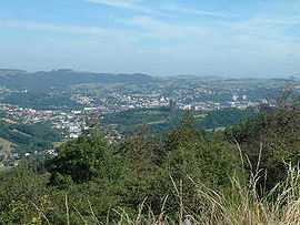
A general view of Firminy | ||
| ||
 Firminy | ||
|
Location within Rhône-Alpes region  Firminy | ||
| Coordinates: 45°23′20″N 4°17′16″E / 45.3889°N 4.2878°ECoordinates: 45°23′20″N 4°17′16″E / 45.3889°N 4.2878°E | ||
| Country | France | |
| Region | Rhône-Alpes | |
| Department | Loire | |
| Arrondissement | Saint-Étienne | |
| Canton | Firminy | |
| Intercommunality | Saint-Étienne Métropole | |
| Government | ||
| • Mayor (2008–2014) | Marc Petit | |
| Area1 | 10.45 km2 (4.03 sq mi) | |
| Population (1999)2 | 19,297 | |
| • Density | 1,800/km2 (4,800/sq mi) | |
| INSEE/Postal code | 42095 / 42700 | |
| Elevation |
446–800 m (1,463–2,625 ft) (avg. 468 m or 1,535 ft) | |
|
1 French Land Register data, which excludes lakes, ponds, glaciers > 1 km² (0.386 sq mi or 247 acres) and river estuaries. 2 Population without double counting: residents of multiple communes (e.g., students and military personnel) only counted once. | ||
.svg.png)
Firminy (Firminiaco: "place of Firmin") is a commune in the Loire department in central France.
It lies on the Ondaine River 8 mi. S.W. of Saint-Étienne by rail.
History
The name was first recorded in a 971 charter by the King of Burgundy.
Sights
Two historic churches from the 12th and 16th centuries are located here. The architect Le Corbusier designed a group of modern buildings, called "Firminy Vert", which includes a church Saint-Pierre, Firminy, cultural center, and an Unité d'Habitation.
Economy
It has important coalmines known since the 14th century and extensive manufactures of iron, steel, and aluminum goods, including railway material, machinery and cannon. Fancy woolen hosiery is also manufactured.
See also
References
-
 This article incorporates text from a publication now in the public domain: Chisholm, Hugh, ed. (1911). Encyclopædia Britannica (11th ed.). Cambridge University Press.
External links
| Wikimedia Commons has media related to Firminy. |
- Official website (French)