Feurs
| Feurs | ||
|---|---|---|
|
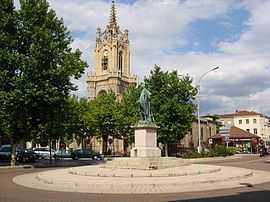
The church with a statue of Michel Combes in the foreground | ||
| ||
 Feurs | ||
|
Location within Rhône-Alpes region  Feurs | ||
| Coordinates: 45°44′30″N 4°13′36″E / 45.7417°N 4.2267°ECoordinates: 45°44′30″N 4°13′36″E / 45.7417°N 4.2267°E | ||
| Country | France | |
| Region | Rhône-Alpes | |
| Department | Loire | |
| Arrondissement | Montbrison | |
| Canton | Feurs | |
| Intercommunality | Feurs en Forez | |
| Government | ||
| • Mayor (2001–2008) | Jean-Pierre Taite | |
| Area1 | 24.39 km2 (9.42 sq mi) | |
| Population (1999)2 | 7,669 | |
| • Density | 310/km2 (810/sq mi) | |
| INSEE/Postal code | 42094 / 42110 | |
| Elevation |
327–366 m (1,073–1,201 ft) (avg. 345 m or 1,132 ft) | |
|
1 French Land Register data, which excludes lakes, ponds, glaciers > 1 km² (0.386 sq mi or 247 acres) and river estuaries. 2 Population without double counting: residents of multiple communes (e.g., students and military personnel) only counted once. | ||
.svg.png)
Feurs is a commune in the Loire department and in the Rhône-Alpes region in central France.
The inhabitants of Feurs are called Foréziens.
History
The name Feurs derives from the Roman name of the town Forum Segusiavorum. Vestiges of the ancient Roman city are located by the current post office.
The city gave its name to the Forez province in which it is located.
Feurs was the capital of the Loire department from 1793 to 1795, during the French Revolution.
Geography
The river Lignon du Forez flows into the Loire in the commune.
Feurs is located in the Forez plain, between the Monts du Lyonnais to the East and the Monts du Forez to the West.
Economy
Over 300 small and medium enterprises are settled in Feurs and account for about 3'200 jobs, distributed as follows : tertiary sector (1675), metal industry (1280), construction (267).[1]
Twin towns
Feurs and the town of Olching in Bavaria, Germany, have been twin towns since August 1963, when a delegation of 24 Foréziens, led by the mayor Félix Nigay, visited their German counterparts for the first time.
Notable residents
- Geoffroy Guichard (1867- 1940), founder of the Casino Group.
- Franck Montagny, Formula 1 pilot
- Joseph-Guichard Du Verney (1648-1730), anatomist.
See also
References
External links
| Wikimedia Commons has media related to Feurs. |
- Bienvenue sur le site de la ville de Feurs
- Gazetteer Entry
- Bienvenue sur le site officiel de l'U.S.Forézienne