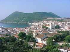
Feteira (Angra do Heroísmo)
| Feteira | |
| Civil Parish | |
| Official name: Freguesia da Feteira | |
| Name origin: Portuguese for a place of many ferns | |
| Country | |
|---|---|
| Autonomous Region | |
| Island | Terceira |
| Municipality | Angra do Heroísmo |
| Localities | Fajã da Lajinha, Feteira, Nossa Senhora da Esperança, Nossa Senhora dos Mercês, Outeiro, Serretinha |
| Center | Feteira |
| - elevation | 162 m (531 ft) |
| - coordinates | 38°39′16″N 27°9′4″W / 38.65444°N 27.15111°WCoordinates: 38°39′16″N 27°9′4″W / 38.65444°N 27.15111°W |
| Highest point | Dona Joana |
| - elevation | 331 m (1,086 ft) |
| - coordinates | 38°39′54″N 27°8′20″W / 38.66500°N 27.13889°W |
| Lowest point | Sea Level |
| - location | Atlantic Ocean |
| Area | 5.25 km2 (2 sq mi) |
| - urban | .30 km2 (0 sq mi) |
| Population | 1,239 (2011) |
| Density | 236 / km2 (611 / sq mi) |
| LAU | Junta Freguesia |
| - location | Cruz das Almas |
| - coordinates | 38°39′20″N 27°8′58″W / 38.65556°N 27.14944°W |
| President Junta | Carlos Manuel Pinto Pinheiro |
| President Assembleia | António Daniel Parreira Sousa |
| Timezone | Azores (UTC-1) |
| - summer (DST) | Azores (UTC0) |
| Postal Zone | 9700-356 |
| Area Code & Prefix | (+351) 292 XXX-XXXX |
| Demonym | Feteirense |
| Patron Saint | Nossa Senhora da Consolação |
 Location of the civil parish seat of Feteira in the municipality of Angra do Heroísmo
| |
| Wikimedia Commons: Feteira (Angra do Heroísmo) | |
| Website: http://freguesiafeteira.com | |
| Geographic detail from CAOP (2010)[1] produced by Instituto Geográfico Português (IGP) | |
Feteira is a civil parish in the municipality of Angra do Heroísmo in the Portuguese archipelago of the Azores. The population in 2011 was 1,239,[2] in an area of 5.25 km².[3]
History
Feterira became an independent administrative territory by decree on 30 November 1906.[4]
The Church of Nossa Senhora da Consolação was officially inaugurated on 20 May 1968, but had to be repaired after damage from the 1980 earthquake.[4]
There were approximately 403 homes in 1991.[4]
Geography

The rural parish is located 7 kilometres (4.3 mi) from the municipal seat of Angra do Heroísmo. The geographic limits of the parish include the parish of Porto Judeu (to the east), Ribeirinha (to the north and west), while it fronts the Atlantic Ocean (to the south).[4]
Although the population has decreased, current statistics indicate a leveling of out-migration.[4]
References
- ↑ IGP, ed. (2010), Carta Administrativa Oficial de Portugal (in Portuguese), Lisbon, Portugal: Instituto Geográfico Português, retrieved 1 July 2011
- ↑ Instituto Nacional de Estatística
- ↑ Eurostat
- ↑ 4.0 4.1 4.2 4.3 4.4 Junta Freguesia, ed. (2009). "Quem Somos" (in Portuguese). Junta Freguesia da Feteira. Retrieved 31 August 2013.