Ferrières-sur-Sichon
| Ferrières-sur-Sichon | ||
|---|---|---|
|
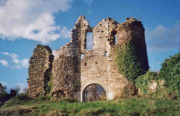
Chateau of Montgilbert | ||
| ||
 Ferrières-sur-Sichon | ||
|
Location within Auvergne region  Ferrières-sur-Sichon | ||
| Coordinates: 46°01′34″N 3°38′59″E / 46.0261°N 3.6497°ECoordinates: 46°01′34″N 3°38′59″E / 46.0261°N 3.6497°E | ||
| Country | France | |
| Region | Auvergne | |
| Department | Allier | |
| Arrondissement | Vichy | |
| Canton | Le Mayet-de-Montagne | |
| Intercommunality | Montagne Bourbonnaise | |
| Government | ||
| • Mayor (2008–2014) | Jean-Marcel Lazzerini | |
| Area1 | 38.58 km2 (14.90 sq mi) | |
| Population (2008)2 | 554 | |
| • Density | 14/km2 (37/sq mi) | |
| INSEE/Postal code | 03113 / 03250 | |
| Elevation |
397–980 m (1,302–3,215 ft) (avg. 554 m or 1,818 ft) | |
|
1 French Land Register data, which excludes lakes, ponds, glaciers > 1 km² (0.386 sq mi or 247 acres) and river estuaries. 2 Population without double counting: residents of multiple communes (e.g., students and military personnel) only counted once. | ||
.svg.png)
Ferrières-sur-Sichon is a commune in the Allier department in central France.
Population
| Historical population | ||
|---|---|---|
| Year | Pop. | ±% |
| 1851 | 3,250 | — |
| 1891 | 1,836 | −43.5% |
| 1901 | 1,747 | −4.8% |
| 1911 | 1,683 | −3.7% |
| 1936 | 1,266 | −24.8% |
| 1946 | 1,026 | −19.0% |
| 1962 | 838 | −18.3% |
| 1968 | 916 | +9.3% |
| 1975 | 795 | −13.2% |
| 1982 | 656 | −17.5% |
| 1990 | 632 | −3.7% |
| 1999 | 561 | −11.2% |
| 2008 | 554 | −1.2% |
Sights
See also
References
| Wikimedia Commons has media related to Ferrières-sur-Sichon. |