Fayetteville National Cemetery
|
Fayetteville National Cemetery | |
 | |
|
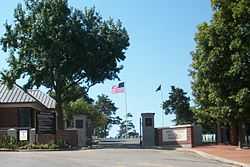
Cemetery entrance on Government Avenue | |
 | |
| Location | 700 Government Ave., Fayetteville, Arkansas |
|---|---|
| Coordinates | 36°03′10″N 94°10′07″W / 36.05278°N 94.16861°WCoordinates: 36°03′10″N 94°10′07″W / 36.05278°N 94.16861°W |
| Area | 11.6 acres (4.7 ha) |
| Built | 1867 |
| Governing body | United States Department of Veterans Affairs |
| MPS | Civil War Era National Cemeteries MPS |
| NRHP Reference # | 99000892[1] |
| Added to NRHP | July 28, 1999 |
Fayetteville National Cemetery is a United States National Cemetery located on the southern side of the city of Fayetteville in Washington County, Arkansas. It encompasses nearly 15 acres (6.1 ha) and as of November 2013, had 8,673 interments.
History
The original plot of 5 acres (2.0 ha) of land for the National Cemetery was purchased from local residents in 1867, it was laid out in sections with space for around 1,800 interments. The first interments were remains moved from battlefield cemeteries of the Battle of Prairie Grove and the Battle of Pea Ridge. By 1871 there were 1,200 interments made in the cemetery, most of which were unidentified.
During World War II the cemetery was enlarged and five more sections were added.
In 1989, the Regional National Cemetery Improvement Corporation (RNCIC - a group of locals, veterans, and other concerned benefactors) raised enough money to purchase an additional 3 acres (1.2 ha) of land, and donated it to the cemetery. The group continued their efforts over the years and donated numerous plots of land. In their latest and largest donation they donated 2.3 acres in ceremonies at the National Cemetery on November 9, 2013.[2]
Fayetteville National Cemetery was placed on the National Register of Historic Places on July 28, 1999.
Notable monuments
- The Revolutionary War Soldier Memorial, erected in the early 1990s.
- The Purple Heart Memorial, erected in 2000 to honor Purple Heart recipients.
Notable interments
- Clarence B. Craft, Medal of Honor recipient
- Vance Randolph, noted Ozarks folklorist and author[3]
See also
References
- ↑ "National Register Information System". National Register of Historic Places. National Park Service. 2009-03-13.
- ↑ http://RNCIC.com
- ↑ Vance Randolph at Find a Grave
External links
- National Cemetery Administration
- Fayetteville National Cemetery
- Fayetteville National Cemetery List of Burials
- Regional National Cemetery Improvement Corp.
- Historic American Buildings Survey (HABS) No. AR-39-A, "Fayetteville National Cemetery, Superintendent's Lodge, 700 Government Avenue, Fayetteville, Washington County, AR", 8 photos, 1 photo caption page
- Historic American Landscapes Survey (HALS) No. AR-1, "Fayetteville National Cemetery, 700 Government Avenue, Fayetteville, Washington County, AR", 36 photos, 3 photo caption pages
- U.S. Geological Survey Geographic Names Information System: Fayetteville National Cemetery
- Fayetteville National Cemetery at Find a Grave
| ||||||||||||||||||||||||||