Fayette, New York
| Fayette, New York | |
|---|---|
| Town | |
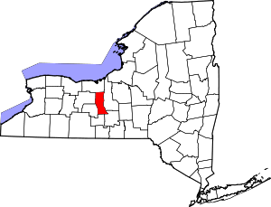
 Fayette, New York Location within the state of New York | |
| Coordinates: 42°51′N 76°52′W / 42.850°N 76.867°WCoordinates: 42°51′N 76°52′W / 42.850°N 76.867°W | |
| Country | United States |
| State | New York |
| County | Seneca |
| Area | |
| • Total | 66.5 sq mi (172.2 km2) |
| • Land | 55.2 sq mi (142.9 km2) |
| • Water | 11.3 sq mi (29.3 km2) |
| Elevation | 574 ft (175 m) |
| Population (2000) | |
| • Total | 3,643 |
| • Density | 66.0/sq mi (25.5/km2) |
| Time zone | Eastern (EST) (UTC-5) |
| • Summer (DST) | EDT (UTC-4) |
| ZIP code | 13065 |
| Area code(s) | 315 |
| FIPS code | 36-25505 |
| GNIS feature ID | 0978954 |
Fayette is a town in Seneca County, New York, United States. The population was 3,643 at the 2000 census.
The Town of Fayette is on the western border of the county and is southeast of Geneva, New York.
History
Seneca was part of the Central New York Military Tract and was first settled around 1790.
The town was established from part of the Town of Romulus in 1800 as the "Town of Washington," but adopted the current name in 1803.
In Fayette on April 6, 1830 Joseph Smith, Jr., who was from nearby Palmyra, New York, organized the Church of Christ, later to be known as the Church of Jesus Christ of Latter Day Saints, in a log home owned by Peter Whitmer, Sr.. Whitmer was one of five others besides Smith who where the initial six members.
In 1980 this reconstructed log home, built on the site of the original Whitmer home, was dedicated as part of the sesquicentennial celebrations of The Church of Jesus Christ of Latter-day Saints (LDS Church). The dedication was done by then LDS Church President Spencer W. Kimball and was broadcast by satellite, as part of the semi-annual church General Conference, to many LDS stake centers around the world. The Whitmer log home continues to be operated as a religious historical site by the LDS Church.
The Christ Evangelical and Reformed Church and William Hoster House are listed on the National Register of Historic Places. The Rose Hill Mansion is a National Historic Landmark.[1]
Notable people
- Peter Whitmer, Sr., a prominent early Mormon, one of the first six members of the church founded by Joseph Smith, Jr. in 1830. The Peter Whitmer log home was rebuilt in 1979-1980 by the LDS Church.
- Red Jacket, "Saguwatha" ("the keeper awake"), the Seneca chief was born here.
- Robert Scott Duncanson, artist
- Robert S. Rose, former US Congressman
Geography
According to the United States Census Bureau, the town has a total area of 66.5 square miles (172 km2), of which, 55.2 square miles (143 km2) of it is land and 11.3 square miles (29 km2) of it (17.00%) is water.
The west town line is Seneca Lake, and the east town line is Cayuga Lake. The north town line is partly marked by the Seneca River, which is part of the Cayuga-Seneca Canal, linked to the Erie Canal system.
New York State Route 89, New York State Route 96, New York State Route 96A, and New York State Route 414 are all north-south highways through the town. New York State Route 336 is a short east-west highway between McDougall and Fayette.
Demographics
As of the census[2] of 2000, there were 3,643 people, 1,367 households, and 1,011 families residing in the town. The population density was 66.0 people per square mile (25.5/km²). There were 1,680 housing units at an average density of 30.4 per square mile (11.8/km²). The racial makeup of the town was 98.08% White, 0.52% African American, 0.27% Native American, 0.58% Asian, 0.05% from other races, and 0.49% from two or more races. Hispanic or Latino of any race were 0.91% of the population.
There were 1,367 households out of which 33.1% had children under the age of 18 living with them, 62.1% were married couples living together, 8.1% had a female householder with no husband present, and 26.0% were non-families. 20.2% of all households were made up of individuals and 9.6% had someone living alone who was 65 years of age or older. The average household size was 2.65 and the average family size was 3.06.
In the town the population was spread out with 25.7% under the age of 18, 7.1% from 18 to 24, 26.7% from 25 to 44, 27.1% from 45 to 64, and 13.4% who were 65 years of age or older. The median age was 39 years. For every 100 females there were 96.2 males. For every 100 females age 18 and over, there were 97.2 males.
The median income for a household in the town was $43,259, and the median income for a family was $52,163. Males had a median income of $34,457 versus $24,737 for females. The per capita income for the town was $19,186. About 4.2% of families and 4.3% of the population were below the poverty line, including 5.4% of those under age 18 and 4.1% of those age 65 or over.
Communities and locations in Fayette
- Canoga – A hamlet near Cayuga Lake by NY-89.
- Canoga Springs – A hamlet in the east part of the town on County Road 121.
- Fayette – The hamlet of Fayette on NY-414 at the south town line.
- Kuneytown – A hamlet south of Canoga Springs, located on County Road 154.
- Pastime Park – A lakeside hamlet on Seneca Lake.
- Rose Hill – A hamlet on NY-96A in the western part of Fayette.
- MacDougall – A hamlet on the south town line on NY-336.
- Seneca Lake State Park – A state park near the northwest part of Fayette at the Seneca River in the Town of Waterloo.
- Teall Beach – A lakeside hamlet on Seneca Lake.
- Waterloo – The south part of the Village of Waterloo is on NY-96 at the north town line.
- Yale – A hamlet on the south town line on County Road 126.
- Yost Corners – A location near the town center.
See also
References
- ↑ "National Register Information System". National Register of Historic Places. National Park Service. 2009-03-13.
- ↑ "American FactFinder". United States Census Bureau. Retrieved 2008-01-31.
External links
- "Places to Visit: Historic Sites", LDS.org (LDS Church)
|chapter=ignored (help) - page from LDS site for the Whitmer farm house, listed as being in nearby Waterloo.
| |||||||||||||||||||||||||||||||||