Farm to Market Road 762
| ||||
|---|---|---|---|---|
| Route information | ||||
| Maintained by TxDOT | ||||
| Length: | 21.328 mi[1] (34.324 km) | |||
| Existed: | December 17, 1947[1] – present | |||
| Major junctions | ||||
| South end: |
| |||
|
| ||||
| North end: |
| |||
| Location | ||||
| Counties: | Fort Bend | |||
| Highway system | ||||
| ||||

Farm to Market Road 762 (FM 762) is a state highway in the U.S. state of Texas that stays within Fort Bend County. The highway begins at FM 1462 south of Brazos Bend State Park, zig-zags in a northerly direction, crosses Interstate 69 (I-69)/U.S. Route 59 (US 59) and ends at U.S. Route 90 Alternate (US 90A) in Richmond.
Route description
FM 762 begins at a stop sign on FM 1462. At the intersection, southbound traffic on FM 762 can use a right-hand curve to access FM 1462 going west. After traveling 1.3 miles (2.1 km) north of the starting point, there is an intersection with Texas Park Road 72 at the entrance of Brazos Bend State Park. From the state park, FM 762 heads north, west, north and northwest for 5.9 miles (9.5 km) before reaching a three-way junction with FM 1994. In the northwesterly stretch, the highway crosses Big Creek and passes under electric transmission lines. At the intersection, FM 762 turns sharply to the northeast, then northwest, then northeast again before passing the George Ranch and curving to the north-northwest. The highway passes the George Ranch High School of the Lamar Consolidated Independent School District before crossing the BNSF Railway tracks and arriving at a stoplight-controlled intersection with FM 2759. From FM 1994 to FM 2759 at Crabb is a distance of 8.8 miles (14.2 km). At the intersection, FM 762 turns sharply left and parallels the BNSF tracks to the west-northwest for 2.5 miles (4.0 km) before coming to a stoplight at FM 2977. As highway starts to curve to the northwest, it crosses a bridge over I-69/US 59 at a distance of 0.3 miles (0.5 km) from the junction with FM 2977. There are shopping centers on the west side of the highway on both sides of I-69/US 59, which is locally called the Southwest Freeway. I-69/US 59 may be accessed in both directions via entrance ramps on the east side of FM 762. From I-69/US 59, FM 762 heads to the northwest alongside the railroad tracks for 1.2 miles (1.9 km) to reach the traffic signal at FM 1640. The George Memorial Library is located on the east side of the intersection. From FM 1640, the highway continues 1.3 miles (2.1 km) nearly north to the stoplight on US 90A at Jackson Street. There is also a spur connection which turns east onto Austin Street for several blocks, then north on Second Street to terminate at the west end of the Brazos River bridge on US 90A.[2]
History
FM 762 was originally designated on December 17, 1947, to start from US 59 at Richmond, go first to Crabb and then south to the Tadpole Road in the direction of Long Point. The total distance was 14.6 miles (23.5 km) and the leg from Crabb to the south was 8.9 miles (14.3 km) in length.[1] The end location was at the 2013 site of the intersection of FM 762 and FM 1994.[note 1] Note that a 1955 map shows that US 59 shared the same route that is used by US 90A in 2013, which is about 3.0 miles (4.8 km) north of the 2013 path of US 59.[3] On July 22, 1949, FM 762 was extended 4.4 miles (7.1 km) toward Long Point.[1]
On May 23, 1951, FM 762 was extended south approximately 10.0 miles (16.1 km) to the county line and then an additional 1.4 miles (2.3 km) into Brazoria County to SH 36 near Damon. At that time, the highway's total distance was 30.1 miles (48.4 km). On October 10, 1961, the last 7.1 miles (11.4 km) segment of the highway going northeast from Damon was transferred to FM 1462. The total length of the highway was 21.3 miles (34.3 km) in 1961. On August 27, 1963, a 0.7 miles (1.1 km) spur connection in Richmond was made by routing the highway east on Austin Street and north on South 2nd Street to US 59 (now US 90A).[1]
Major intersections
The entire highway is in Fort Bend County.
| Location | mi | km | Destinations | Notes | |
|---|---|---|---|---|---|
| 0.0 | 0.0 | Southern terminus of FM 762 | |||
| 1.3 | 2.1 | Brazos Bend State Park | |||
| Long Point | 7.2 | 11.6 | Whaley-Long Point Road | ||
| Crabb | 16.0 | 25.7 | Crabb River Road | ||
| Rosenberg | 18.5 | 29.8 | Minonite Road | ||
| 18.8 | 30.3 | Southwest Freeway | |||
| Richmond | 20.0 | 32.2 | Avenue I | ||
| 21.3 | 34.3 | Northern terminus of FM 762 | |||
| 1.000 mi = 1.609 km; 1.000 km = 0.621 mi | |||||
Gallery
-
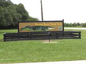
Brazos Bend State Park at Park Road 72
-

View northwest at FM 2759 (Crabb River Road)
-

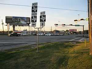
Looking northwest at FM 2977 in Rosenberg
-
View northwest at FM 1640 in Richmond
See also
- Texas portal
- U.S. Roads portal
Notes
Route map: Bing
- Footnotes
- ↑ This was determined by measuring 8.9 miles of map distance on the 2013 highway starting from Crabb.
- Citations
- ↑ 1.0 1.1 1.2 1.3 1.4 Transportation Planning and Programming Division. "Farm to Market Road No. 762". Highway Designation Files. Texas Department of Transportation. Retrieved January 13, 2013.
- ↑ Google (April 26, 2013). "Farm to Market Road 762" (Map). Google Maps. Google. Retrieved April 26, 2013.
- ↑ "Sugar Land Quadrangle 15 Minute Series". United States Geological Survey. 1955. Retrieved January 12, 2013.