Fargues, Lot
| Fargues | |
|---|---|
|
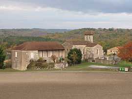
The church of Farguettes | |
 Fargues | |
|
Location within Midi-Pyrénées region  Fargues | |
| Coordinates: 44°23′59″N 1°10′56″E / 44.3997°N 1.1822°ECoordinates: 44°23′59″N 1°10′56″E / 44.3997°N 1.1822°E | |
| Country | France |
| Region | Midi-Pyrénées |
| Department | Lot |
| Arrondissement | Arrondissement of Cahors |
| Canton | Canton of Montcuq |
| Intercommunality | Communauté de communes du Canton de Montcuq |
| Government | |
| • Mayor (2001–2008) | André Seménadisse |
| Area1 | 14.79 km2 (5.71 sq mi) |
| Population (1999)2 | 149 |
| • Density | 10/km2 (26/sq mi) |
| INSEE/Postal code | 46099 / 46800 |
| Elevation |
155–289 m (509–948 ft) (avg. 266 m or 873 ft) |
|
1 French Land Register data, which excludes lakes, ponds, glaciers > 1 km² (0.386 sq mi or 247 acres) and river estuaries. 2 Population without double counting: residents of multiple communes (e.g., students and military personnel) only counted once. | |
Fargues is a commune in the Lot department in south-western France.
Geography
The Séoune forms part of the commune's southern border.
See also
| Wikimedia Commons has media related to Fargues (Lot). |