Farah, India
| Farah | |
|---|---|
| Town | |
|
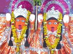
Farah Devi Mata | |
 Farah Location in Uttar Pradesh, India | |
| Coordinates: 27°20′N 77°46′E / 27.33°N 77.77°ECoordinates: 27°20′N 77°46′E / 27.33°N 77.77°E | |
| Country |
|
| State | Uttar Pradesh |
| District | Mathura |
| Elevation | 172 m (564 ft) |
| Population (2001) | |
| • Total | 8,199 |
| Languages | |
| • Official | Hindi |
| Time zone | IST (UTC+5:30) |
| Website | www.npfarah.in |
Farah is a town and a nagar panchayat in Mathura district in the state of Uttar Pradesh, India.
Climate
Farah features a semiarid climate that borders on a humid subtropical climate. The town features mild winters, hot and dry summers and a monsoon season. However the monsoons, though substantial in Farah, are not quite as heavy as the monsoon in other parts of India. This is a primary factor in Farah featuring a semiarid climate as opposed to a humid subtropical climate.
| Climate data for Farah, India | |||||||||||||
|---|---|---|---|---|---|---|---|---|---|---|---|---|---|
| Month | Jan | Feb | Mar | Apr | May | Jun | Jul | Aug | Sep | Oct | Nov | Dec | Year |
| Average high °C (°F) | 22.3 (72.1) |
25.5 (77.9) |
31.9 (89.4) |
37.9 (100.2) |
41.7 (107.1) |
40.7 (105.3) |
35.3 (95.5) |
33.2 (91.8) |
34.0 (93.2) |
34.0 (93.2) |
29.2 (84.6) |
23.9 (75) |
32.47 (90.44) |
| Average low °C (°F) | 7.7 (45.9) |
10.3 (50.5) |
15.4 (59.7) |
21.5 (70.7) |
26.5 (79.7) |
28.9 (84) |
26.8 (80.2) |
25.7 (78.3) |
24.3 (75.7) |
19.1 (66.4) |
12.5 (54.5) |
8.2 (46.8) |
18.91 (66.03) |
| Average rainfall mm (inches) | 13.3 (0.524) |
17.7 (0.697) |
9.1 (0.358) |
6.7 (0.264) |
11.9 (0.469) |
55.7 (2.193) |
203.3 (8.004) |
241.1 (9.492) |
128.5 (5.059) |
25.2 (0.992) |
4.3 (0.169) |
6.0 (0.236) |
722.8 (28.457) |
| Avg. rainy days | 1.9 | 1.7 | 1.7 | 1.3 | 2.3 | 4.7 | 13.8 | 14.9 | 7.7 | 1.5 | 0.8 | 1.0 | 53.3 |
| Source: World Meteorological Organization.[1] | |||||||||||||
Geography
Farah is located at 27°20′N 77°46′E / 27.33°N 77.77°E.[2] It has an average elevation of 172 metres (564 feet).
Demographics
As of 2001 India census,[3] Farah had a population of 8199. Males constitute 54% of the population and females 46%. Farah has an average literacy rate of 52%, lower than the national average of 59.5%: male literacy is 61%, and female literacy is 41%. In Farah, 20% of the population is under 6 years of age.
Landmarks
There are some reputed and old shops/Temples in Farah those shops has become landmark. Some of them are: * Farah Devi Mandir
*Parishadiya Vetan Bhogi Shikshak/karmchari Sahkari sakh Samiti Limited, Farah Mathura(U.P.)'
'*Pathwari Mandir'
Government Institute
Central Institute Of Research on Goats (Known as CIRG) which is under ICAR (Indian Council Of Agricultural Research) and is the only institute for research on goats in India.
Institutes
There are many Engineering and Degree Colleges in Farah. Some of them are:
- Sachdeva Institute Of Technology
- Hindustan College Of Science and Technology
- Nikhil Institute Of Technology
- Eshan College Of Engineering
- Hardayal Technical Campus
- Usha Educational Institute
- Aashlar Business School
- Unnati Management College
- Vishnu Computer Education (Indira Gandhi Computer Saksharta Mission)
- Computer Home (Opp CIRG Crossing, Near Power House, Farah(Mathura) UP 281122
Nearby Cities
References
- ↑ World Weather Information Service-Farah, World Meteorological Organization. Retrieved 30 September 2012.
- ↑ Falling Rain Genomics, Inc - Farah
- ↑ "Census of India 2001: Data from the 2001 Census, including cities, villages and towns (Provisional)". Census Commission of India. Archived from the original on 2004-06-16. Retrieved 2008-11-01.
| ||||||||||