Eyota, Minnesota
| Eyota, Minnesota | |
|---|---|
| City | |
|
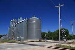
Grain elevator in Eyota. | |
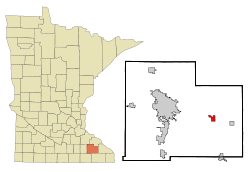 Location of Eyota, Minnesota | |
| Coordinates: 43°59′14″N 92°13′54″W / 43.98722°N 92.23167°W | |
| Country | United States |
| State | Minnesota |
| County | Olmsted |
| Area[1] | |
| • Total | 1.69 sq mi (4.38 km2) |
| • Land | 1.69 sq mi (4.38 km2) |
| • Water | 0 sq mi (0 km2) |
| Elevation | 1,240 ft (378 m) |
| Population (2010)[2] | |
| • Total | 1,977 |
| • Estimate (2012[3]) | 2,020 |
| • Density | 1,169.8/sq mi (451.7/km2) |
| Time zone | Central (CST) (UTC-6) |
| • Summer (DST) | CDT (UTC-5) |
| ZIP code | 55934 |
| Area code(s) | 507 |
| FIPS code | 27-20114[4] |
| GNIS feature ID | 0643483[5] |
Eyota is a city in Olmsted County, Minnesota, United States. The population was 1,977 at the 2010 census.[6]
History
Eyota is derived from the Sioux Indian word iyotak, meaning "greatest" or "most".[7]
Geography
According to the United States Census Bureau, the city has a total area of 1.69 square miles (4.38 km2), all of it land.[1]
The south branch of the Whitewater River passes through the northern edge of the city.
U.S. Route 14 and Minnesota State Highway 42 are two of the main routes in the community. Interstate 90 is immediately south of the city.
Demographics
2010 census
As of the census[2] of 2010, there were 1,977 people, 758 households, and 542 families residing in the city. The population density was 1,169.8 inhabitants per square mile (451.7/km2). There were 790 housing units at an average density of 467.5 per square mile (180.5/km2). The racial makeup of the city was 98.9% White, 0.2% African American, 0.1% Native American, 0.2% Asian, 0.2% from other races, and 0.4% from two or more races. Hispanic or Latino of any race were 0.7% of the population.
There were 758 households of which 41.3% had children under the age of 18 living with them, 56.5% were married couples living together, 10.2% had a female householder with no husband present, 4.9% had a male householder with no wife present, and 28.5% were non-families. 24.0% of all households were made up of individuals and 9.7% had someone living alone who was 65 years of age or older. The average household size was 2.61 and the average family size was 3.11.
The median age in the city was 34.4 years. 30.3% of residents were under the age of 18; 6.7% were between the ages of 18 and 24; 27.7% were from 25 to 44; 24.5% were from 45 to 64; and 10.9% were 65 years of age or older. The gender makeup of the city was 49.8% male and 50.2% female.
2000 census
As of the census[4] of 2000, there were 1,644 people, 597 households, and 456 families residing in the city. The population density was 1,058.4 people per square mile (409.5/km²). There were 614 housing units at an average density of 395.3 per square mile (152.9/km²). The racial makeup of the city was 98.36% White, 0.18% African American, 0.12% Native American, 0.43% Asian, 0.06% from other races, and 0.85% from two or more races. Hispanic or Latino of any race were 0.43% of the population.
There were 597 households out of which 44.6% had children under the age of 18 living with them, 60.1% were married couples living together, 10.4% had a female householder with no husband present, and 23.5% were non-families. 19.4% of all households were made up of individuals and 7.4% had someone living alone who was 65 years of age or older. The average household size was 2.75 and the average family size was 3.15.
In the city the population was spread out with 31.7% under the age of 18, 8.2% from 18 to 24, 30.8% from 25 to 44, 20.2% from 45 to 64, and 9.1% who were 65 years of age or older. The median age was 32 years. For every 100 females there were 92.3 males. For every 100 females age 18 and over, there were 96.0 males.
The median income for a household in the city was $47,500, and the median income for a family was $53,036. Males had a median income of $36,548 versus $28,259 for females. The per capita income for the city was $18,471. About 2.8% of families and 3.2% of the population were below the poverty line, including 3.5% of those under age 18 and 8.1% of those age 65 or over.
Government
The city government consists of a mayor and four council members. The current mayor is Tyrel Clark (current term Jan. 2013 to Dec 2014); mayoral terms are two years. Tyrel previously was a council member; Kurt Holst was appointed to fill the remainder of Clark's council term. The council members for 2013-2014 are Bryan Cornell (current term Jan. 2013 to Dec 2016), Tony Nelson (current term Jan. 2013 to Dec. 2016), Kurt Holst (current term Jan. 2013 to Dec 2014), and Ray Schuchard (current term Jan. 2011 to Dec 2014); council member terms are four years unless appointed to a vacant position.
School District
Eyota is part of the Dover-Eyota School District.
General Facts
The name "Eyota" was an American Indian word that meant "Superior". One theory is that early settlers hoped to express that the land in the area was high quality and would attract additional settlers. Another theory is that the word actually refers to its elevation being higher than the surrounding area.
There are seven parks in town, a skate park, a disc golf course, a cafe, a furniture repair shop, piano sales and service shop, three hairdressers, a post office, a commercial 24/7 workout gym, a mechanic shop, a veterinarian, an American Legion post, a grain elevator, a convenience store, a grocery store, and a bird shop.
Two of the streets, named Rena Belle and Carol Ann, were named after the town's two oldest residents at the time that the streets were built.
According to Su Spafford, a person who lives in Eyota is referred to as an Eyotian. However, this is a debatable fact within the community.
References
- ↑ 1.0 1.1 "US Gazetteer files 2010". United States Census Bureau. Retrieved 2012-11-13.
- ↑ 2.0 2.1 "American FactFinder". United States Census Bureau. Retrieved 2012-11-13.
- ↑ "Population Estimates". United States Census Bureau. Retrieved 2013-05-28.
- ↑ 4.0 4.1 "American FactFinder". United States Census Bureau. Retrieved 2008-01-31.
- ↑ "US Board on Geographic Names". United States Geological Survey. 2007-10-25. Retrieved 2008-01-31.
- ↑ "2010 Census Redistricting Data (Public Law 94-171) Summary File". American FactFinder. United States Census Bureau. Retrieved 27 April 2011.
- ↑ Gannett, Henry (1905). The Origin of Certain Place Names in the United States. Govt. Print. Off. p. 122.
| |||||||||||||||||||||||||
Coordinates: 43°59′20.04″N 92°13′44.76″W / 43.9889000°N 92.2291000°W