Everton, Missouri
| Everton, Missouri | |
|---|---|
| City | |
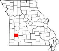
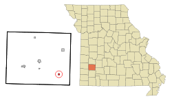 Location of Everton, Missouri | |
| Coordinates: 37°20′37″N 93°42′9″W / 37.34361°N 93.70250°WCoordinates: 37°20′37″N 93°42′9″W / 37.34361°N 93.70250°W | |
| Country | United States |
| State | Missouri |
| County | Dade |
| Area[1] | |
| • Total | 0.35 sq mi (0.91 km2) |
| • Land | 0.35 sq mi (0.91 km2) |
| • Water | 0 sq mi (0 km2) |
| Elevation | 1,089 ft (332 m) |
| Population (2010)[2] | |
| • Total | 319 |
| • Estimate (2012[3]) | 305 |
| • Density | 911.4/sq mi (351.9/km2) |
| Time zone | Central (CST) (UTC-6) |
| • Summer (DST) | CDT (UTC-5) |
| ZIP code | 65646 |
| Area code(s) | 417 |
| FIPS code | 29-22996[4] |
| GNIS feature ID | 0717698[5] |
Everton is a city in Dade County, Missouri, United States. The population was 319 at the 2010 census.
History
Everton was platted in 1881.[6]
Geography
Everton is located at 37°20′37″N 93°42′9″W / 37.34361°N 93.70250°W (37.343574, -93.702611).[7]
According to the United States Census Bureau, the city has a total area of 0.35 square miles (0.91 km2), all of it land.[1]
Demographics
2010 census
As of the census[2] of 2010, there were 319 people, 128 households, and 90 families residing in the city. The population density was 911.4 inhabitants per square mile (351.9/km2). There were 168 housing units at an average density of 480.0 per square mile (185.3/km2). The racial makeup of the city was 94.7% White, 0.9% African American, 1.6% Native American, and 2.8% from two or more races. Hispanic or Latino of any race were 1.6% of the population.
There were 128 households of which 31.3% had children under the age of 18 living with them, 58.6% were married couples living together, 7.0% had a female householder with no husband present, 4.7% had a male householder with no wife present, and 29.7% were non-families. 27.3% of all households were made up of individuals and 11% had someone living alone who was 65 years of age or older. The average household size was 2.49 and the average family size was 2.99.
The median age in the city was 39.3 years. 25.7% of residents were under the age of 18; 6.5% were between the ages of 18 and 24; 24.1% were from 25 to 44; 27.7% were from 45 to 64; and 16% were 65 years of age or older. The gender makeup of the city was 50.8% male and 49.2% female.
2000 census
As of the census[4] of 2000, there were 322 people, 134 households, and 88 families residing in the city. The population density was 939.3 people per square mile (365.7/km²). There were 159 housing units at an average density of 463.8 per square mile (180.6/km²). The racial makeup of the city was 97.52% White, 0.93% Native American, and 1.55% from two or more races. Hispanic or Latino of any race were 0.31% of the population.
There were 134 households out of which 28.4% had children under the age of 18 living with them, 51.5% were married couples living together, 9.7% had a female householder with no husband present, and 34.3% were non-families. 31.3% of all households were made up of individuals and 18.7% had someone living alone who was 65 years of age or older. The average household size was 2.40 and the average family size was 3.05.
In the city the population was spread out with 25.8% under the age of 18, 9.9% from 18 to 24, 23.6% from 25 to 44, 24.8% from 45 to 64, and 15.8% who were 65 years of age or older. The median age was 38 years. For every 100 females there were 84.0 males. For every 100 females age 18 and over, there were 83.8 males.
The median income for a household in the city was $30,208, and the median income for a family was $33,571. Males had a median income of $28,125 versus $16,111 for females. The per capita income for the city was $11,464. About 16.3% of families and 20.3% of the population were below the poverty line, including 22.1% of those under age 18 and 33.3% of those age 65 or over.
References
- ↑ 1.0 1.1 "US Gazetteer files 2010". United States Census Bureau. Retrieved 2012-07-08.
- ↑ 2.0 2.1 "American FactFinder". United States Census Bureau. Retrieved 2012-07-08.
- ↑ "Population Estimates". United States Census Bureau. Retrieved 2013-05-30.
- ↑ 4.0 4.1 "American FactFinder". United States Census Bureau. Retrieved 2008-01-31.
- ↑ "US Board on Geographic Names". United States Geological Survey. 2007-10-25. Retrieved 2008-01-31.
- ↑ Eaton, David Wolfe (1916). How Missouri Counties, Towns and Streams Were Named. The State Historical Society of Missouri. p. 283.
- ↑ "US Gazetteer files: 2010, 2000, and 1990". United States Census Bureau. 2011-02-12. Retrieved 2011-04-23.
| |||||||||||||||||||||||||||||