Euston Road
|
Euston Road at Warren Street tube station, with the BT Tower in the background | |
| Other name(s) |
|
|---|---|
| Former name(s) | New Road |
| Length | 1.0 mi[1] (1.6 km) |
| west end | Great Portland Street |
| east end | London King's Cross railway station |
| Construction | |
| Inauguration | September 1756 |
Euston Road is an important thoroughfare in central London, England, and forms part of the A501. It was originally the central section of the New Road from Paddington to Islington, opened in 1756, London's first bypass, through the fields to the north of London, now generally regarded as being in central London.
The road runs from west to east from Marylebone Road to Pentonville Road. It meets the northern end of Tottenham Court Road at a large junction where there is an underpass.
History of the New Road
The New Road was enabled by an act of Parliament passed in 1756. Construction began in May that year, and it was open to traffic by September.[2] It was intended to provide a new route for the driving of sheep and cattle to Smithfield Market, and so it terminated at Islington at St John's Street.
It also provided a quicker route for army units to reach the Essex coast when there was a threat of invasion, without passing through the Cities of London and Westminster.[2] Building of the road was opposed by the Duke of Bedford as it cut off his estate in what is now Bloomsbury from the countryside.
A clause in the act of 1756 stipulated that no buildings should be constructed within 50 feet (15 m) of the road, with the result that most of the houses along it lay behind substantial gardens. During the nineteenth century this regulation was increasingly ignored.[2] In 1837 Euston Station opened on the north side. The Dukes of Grafton had become the main property owners in the area and, in 1857, the central section of the road, between Osnaburgh Street and Kings Cross, was renamed Euston Road[3] after Euston Hall, their country house. The eastern section became Pentonville Road, the western Marylebone Road.[2]
The full length of the road was dug up to allow for the construction beneath it of the Metropolitan Railway.[4]

The area around the junction with Tottenham Court Road suffered significant bomb damage during the Second World War. Under the Greater London Plan of Patrick Abercrombie, the road was widened. In 1960-1 major modifications resulted in the destruction of the entrance to Euston Station and the construction of the underpass at the junction with Tottenham Court Road. During the 1960s, office developments grew up around this junction, including the Euston Tower skyscraper that now forms part of Regent's Place. Euston Tower attracted a number of significant tenants, most notably the former ITV broadcaster Thames Television, which had its corporate headquarters and a number of studios there from 1970 to 1992, and Capital Radio.
The road is on the edge of the London congestion charge zone, which means that users are not charged for using it, but are charged if they turn south into the zone. The road approximately marks the northern boundary of Travelcard Zone 1 of Transport for London.
The road appears in the London edition of the board game Monopoly.
Notable architecture
King's Cross and St Pancras railway stations are at the eastern end of the road, the British Library is nearby, and Euston railway station is a little further west. Euston Tower is also on the road. Both the old and new headquarters of the Wellcome Trust are on the south side.
About halfway along, at the junction with Upper Woburn Place, is St Pancras New Church. Almost opposite is the Euston Road fire station, built 1901–2, in an "Arts and Crafts" style. It was designed by Percy Nobbs (1875–1964). At 100–110 is the Shaw Theatre. It was built in honour of George Bernard Shaw in 1971, and completely rebuilt in 1998. The new University College Hospital building is on the south side.
Proposals
In 2002 the Greater London Authority commissioned a plan for the improvement of the road from the prominent architectural firm Terry Farrell and Partners. The study is ongoing, with some minor changes to the streetscape already applied. The work was supplemented in 2007 by a parallel investigation by the postgraduate Architecture Design Studio 15 at the University of Westminster.
Major redevelopment works are ongoing at the east end of the road linking King's Cross and St Pancras railway stations, with a new passenger concourse and access to Continental Europe via High Speed 1.
West to East
| South | North | |
|---|---|---|
| ← towards the centre | ↑ | away from the centre → |
| West: Marylebone Road | ||
| Great Portland Street | Albany Road | |
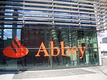
 Abbey head office. | ||
| Tottenham Court Road | Hampstead Road | |
| Gower Street | ||
| Upper Woburn Place | Eversholt Street | |
 UNISON head office |
||
| Gray's Inn Road | York Way | |
| East: Pentonville Road | ||
| ← towards the centre | ↓ | away from the centre → |
| South | North | |
Tube stations on the road
From west to east:
- Regent's Park
- Great Portland Street
- Warren Street
- Euston Square
- Euston station
- King's Cross St Pancras
References
- ↑ "Driving directions to Euston Rd/A501". Google. Retrieved 5 October 2013.
- ↑ 2.0 2.1 2.2 2.3 Timbs, John (1867) [First edition published 1855]. Curiosities of London (New ed.). London: J.S. Virtue. pp. 613–4.
- ↑ "Judd Place West". UCL Bloomsbury Project. UCL. Retrieved 17 January 2014.
- ↑ Palmer, Samuel (1870). St Pancras. London. pp. 242–4.
External links
| Wikimedia Commons has media related to Euston Road. |


