Eureka Springs, Arkansas
| Eureka Springs, Arkansas | |
|---|---|
| City | |
|
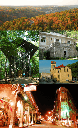
Clockwise, from top: aerial view of Eureka Springs, Eureka Springs Public Library, Carroll County Courthouse, Commercial Historic District at night, Thorncrown Chapel | |
| Nickname(s): "Eureka", "Little Switzerland of America", "The Stairstep Town" | |
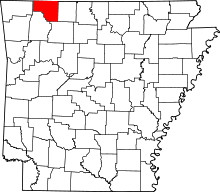
 Location in Carroll County (left) and Arkansas (right) | |
| Coordinates: 36°24′11″N 93°44′18″W / 36.40306°N 93.73833°WCoordinates: 36°24′11″N 93°44′18″W / 36.40306°N 93.73833°W | |
| Country | United States |
| State | Arkansas |
| County | Carroll |
| Government | |
| • Type | Mayor–council government |
| • Mayor | Morris R. Pate |
| Area | |
| • Total | 6.9 sq mi (17.9 km2) |
| • Land | 6.8 sq mi (17.5 km2) |
| • Water | 0.2 sq mi (0.4 km2) |
| Elevation | 1,260 ft (384 m) |
| Population (2010)[1] | |
| • Total | 2,073 |
| • Density | 306/sq mi (118.2/km2) |
| Time zone | Central (CST) (UTC-6) |
| • Summer (DST) | CDT (UTC-5) |
| ZIP codes | 72631-72632 |
| Area code | 479, exchange 253 |
| FIPS code | 05-22240 |
| GNIS feature ID | 0048926 |
| Website |
www |
|
Eureka Springs Historic District (Boundary Increase) | |
| Location | South Main Street |
| Area | 5 acres (2.0 ha) |
| Built | 1913 |
| Governing body | Private |
| NRHP Reference # | 79003730[2] |
| Added to NRHP | January 29, 1979 |
Eureka Springs is a city in Carroll County, Arkansas, United States, and one of two county seats for the county.[3] It is located in the Ozark Mountains of northwest Arkansas. As of the 2010 census, the city population was 2,073.[1]
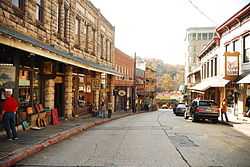
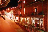
The entire city is on the National Register of Historic Places as the Eureka Springs Historic District, and a popular tourist destination. Eureka Springs is a unique Victorian resort village. The city has steep winding streets filled with Victorian-style cottages and manors. The old commercial section of the city has an alpine character, with an extensive streetscape of well-preserved Victorian buildings. The buildings are primarily constructed of local stone and lie along streets that curve around the hills and rise and fall with the topography in a five-mile long loop. Some buildings have street-level entrances on more than one floor. Eureka Springs has been selected as one of America's Distinctive Destinations by the National Trust for Historic Preservation. Eureka Springs has historically been called "The Little Switzerland of America" and "The Stairstep Town" because of its mountainous terrain and the winding, up-and-down paths of its streets and walkways. The streets wind around the town, and no two intersect at a 90 degree angle; there are no traffic lights.
History


Native American legends tell of a Great Healing Spring in the Eureka Springs area, and various cultures visited the springs for this sacred purpose.
The European Americans were another culture to consider the springs to have healing powers. After the Europeans arrived, they described the waters of the springs as having magical powers. Within a short time in the late nineteenth century, Eureka Springs was transformed into a flourishing city, spa, and tourist destination. Dr. Alvah Jackson was credited in American history with locating the spring and in 1856 claimed that the waters of Basin Spring had cured his eye ailments. Dr. Jackson established a hospital in a local cave during the Civil War and used the waters from Basin Spring to treat his patients. After the war, Jackson marketed the spring waters as "Dr. Jackson's Eye Water". The Ozarka Water Company was later formed in Eureka Springs in 1905.
In 1879 Judge J.B. Saunders, a friend of Jackson, claimed that his crippling disease was cured by the spring waters. Saunders started promoting Eureka Springs to friends and family members across the state and created a boomtown. Within a period of little more than one year, the city grew from a rural spa village to a major city.
On February 14, 1880, Eureka Springs was incorporated as a city. Thousands of visitors came to the springs based on Saunders' promotion and covered the area with tents and shanties. In 1881, Eureka Springs enjoyed the status of Arkansas's fourth largest city, and in 1889 it was the second largest city, behind Little Rock.
After his term as a Reconstruction governor, Powell Clayton moved to the heavily Unionist Eureka Springs and began promoting the city and its commercial interests. Clayton promoted the town as a retirement community for the wealthy. Eureka Springs soon became known for gracious living and a wealthy lifestyle.
Carrie Nation moved here towards the end of her life and founded Hatchet Hall on Steele Street, later operated as a museum, but now closed.
The only bank robbery to occur in Eureka Springs was on September 27, 1922, when five outlaws from Oklahoma tried to rob the First National Bank. Three of the men were killed and two others wounded.
In 1967, the famous 7-story Christ of the Ozarks Statue was built, and a year later, The Great Passion Play began. It is regularly performed from May through October by a cast of 170 actors and dozens of live animals.[4] Since its first performance it has been seen by over 7.7 million people, which makes it the largest-attended outdoor drama in America according to the Institute of Outdoor Theatre of the University of East Carolina at Greenville, North Carolina.[5] Later, a New Holy Land Tour was added, featuring a full-scale re-creation of the Tabernacle in the Wilderness, a section of the Berlin Wall, and a Bible Museum with over 6,000 Bibles (including an original 1611 King James Bible, a leaf from the Gutenberg Bible, and the only Bible signed by all of the original founders of the Gideons.
In 1980, the architect E. Fay Jones designed Thorncrown Chapel. It won design awards at the time and in 2006 was selected for the "Twenty-five Year Award" by the American Institute of Architects, which recognizes structures that have had significant influence on the profession. Because of the special nature and quality of its architecture, the chapel was listed on the National Register of Historic Places in 2000.
Victorian era architecture
In 1882, the Eureka Improvement Company was formed to attract a railroad to the city. With the completion of the railroad, Eureka Springs established itself as a vacation resort. In only two years, thousands of homes and commercial enterprises were constructed. The Crescent Hotel was built in 1886 and the Basin Park Hotel in 1905. These many Victorian buildings have been well preserved, forming a coherent streetscape that has been recognized for its quality.
Geography
Eureka Springs is located in western Carroll County at 36°24′11″N 93°44′18″W / 36.40306°N 93.73833°W (36.403068, -93.738450).[6] According to the United States Census Bureau, the city has a total area of 6.9 square miles (17.9 km2), of which 6.8 square miles (17.5 km2) is land and 0.15 square miles (0.4 km2), or 2.02%, is water.[7] The center of the city is in a narrow valley at the headwaters of Leatherwood Creek, a north-flowing tributary of the White River. Houses and streets climb both sides of the valley to the surrounding ridgecrests. U.S. Route 62 runs along a ridgecrest through the southern part of the city and leads east 11 miles (18 km) to Berryville and west 34 miles (55 km) to Rogers. Arkansas Highway 23 is Main Street through the center of Eureka Springs and leads north 11 miles (18 km) to the Missouri state line.
The city was originally founded when the springs at this location were more evident. Over-extraction of water from the springs has greatly diminished their flow rates. All springs in the town are cold-water springs, and there are more than 140 of them.[8]
Climate
The climate in this area is characterized by hot, humid summers and generally mild to cool winters. According to the Köppen Climate Classification system, Eureka Springs has a humid subtropical climate, abbreviated "Cfa" on climate maps.[9]
| Climate data for Eureka Springs, Arkansas (1981–2010 normals) | |||||||||||||
|---|---|---|---|---|---|---|---|---|---|---|---|---|---|
| Month | Jan | Feb | Mar | Apr | May | Jun | Jul | Aug | Sep | Oct | Nov | Dec | Year |
| Record high °F (°C) | 78 (26) |
81 (27) |
88 (31) |
96 (36) |
93 (34) |
101 (38) |
106 (41) |
105 (41) |
105 (41) |
91 (33) |
86 (30) |
76 (24) |
106 (41) |
| Average high °F (°C) | 46.7 (8.2) |
51.9 (11.1) |
61.6 (16.4) |
71.7 (22.1) |
77.5 (25.3) |
84.0 (28.9) |
88.9 (31.6) |
89.5 (31.9) |
81.0 (27.2) |
69.1 (20.6) |
59.1 (15.1) |
48.0 (8.9) |
69.1 (20.6) |
| Average low °F (°C) | 28.1 (−2.2) |
31.7 (−0.2) |
39.6 (4.2) |
48.7 (9.3) |
56.8 (13.8) |
64.4 (18) |
68.9 (20.5) |
67.9 (19.9) |
60.2 (15.7) |
49.2 (9.6) |
40.4 (4.7) |
30.1 (−1.1) |
48.8 (9.3) |
| Record low °F (°C) | −14 (−26) |
−8 (−22) |
2 (−17) |
21 (−6) |
35 (2) |
46 (8) |
51 (11) |
47 (8) |
34 (1) |
19 (−7) |
7 (−14) |
−15 (−26) |
−15 (−26) |
| Average precipitation inches (mm) | 2.64 (67.1) |
2.88 (73.2) |
4.39 (111.5) |
4.39 (111.5) |
5.10 (129.5) |
4.34 (110.2) |
3.58 (90.9) |
3.27 (83.1) |
4.61 (117.1) |
3.46 (87.9) |
4.31 (109.5) |
3.43 (87.1) |
46.41 (1,178.8) |
| Average snowfall inches (cm) | 3.8 (9.7) |
4.4 (11.2) |
2.6 (6.6) |
0.1 (0.3) |
0 (0) |
0 (0) |
0 (0) |
0 (0) |
0 (0) |
0.1 (0.3) |
0.3 (0.8) |
2.6 (6.6) |
13.8 (35.1) |
| Avg. precipitation days (≥ 0.01 in) | 7.1 | 8.0 | 9.9 | 9.9 | 11.8 | 10.2 | 8.2 | 7.4 | 8.1 | 6.5 | 8.4 | 8.2 | 103.6 |
| Avg. snowy days (≥ 0.1 in) | 2.4 | 2.6 | 0.9 | 0 | 0 | 0 | 0 | 0 | 0 | 0 | 0.2 | 2.0 | 8.2 |
| Source #1: NOAA[10] | |||||||||||||
| Source #2: The Weather Channel[11] | |||||||||||||
Demographics
| Historical population | |||
|---|---|---|---|
| Census | Pop. | %± | |
| 1880 | 3,984 | — | |
| 1890 | 3,706 | −7.0% | |
| 1900 | 3,572 | −3.6% | |
| 1910 | 3,228 | −9.6% | |
| 1920 | 2,429 | −24.8% | |
| 1930 | 2,276 | −6.3% | |
| 1940 | 1,770 | −22.2% | |
| 1950 | 1,958 | 10.6% | |
| 1960 | 1,437 | −26.6% | |
| 1970 | 1,670 | 16.2% | |
| 1980 | 1,989 | 19.1% | |
| 1990 | 1,900 | −4.5% | |
| 2000 | 2,278 | 19.9% | |
| 2010 | 2,073 | −9.0% | |
| U.S. Decennial Census | |||
As of the census[12] of 2000, there were 2,278 people, 1,119 households, and 569 families residing in the city. The population density was 336.2 people per square mile (129.7/km²). There were 1,301 housing units at an average density of 192.0 per square mile (74.1/km²). The racial makeup of the city was 93.94% White, 0.04% Black or African American, 0.70% Native American, 0.79% Asian, 0.09% Pacific Islander, 2.28% from other races, and 2.15% from two or more races. 3.99% of the population were Hispanic or Latino of any race.
There are 1,119 households, of which 19.2% have children under the age of 18 living with them, 37.4% were married couples living together, 10.9% had a female householder with no husband present, and 49.1% are classified as non-families by the United States Census Bureau. Of 1,119 households, 54 are unmarried partner households: 36 heterosexual, 10 same-sex male, and 8 same-sex female households. 41.0% of all households were made up of individuals and 13.4% had someone living alone who was 65 years of age or older. The average household size was 1.97 and the average family size was 2.64.
In the city the population was spread out with 17.2% under the age of 18, 5.8% from 18 to 24, 24.4% from 25 to 44, 33.4% from 45 to 64, and 19.3% who were 65 years of age or older. The median age was 46 years. For every 100 females there were 81.8 males. For every 100 females age 18 and over, there were 81.2 males.
The median income for a household in the city was $25,547, and the median income for a family was $40,341. Males had a median income of $27,188 versus $17,161 for females. The per capita income for the city was $18,439. About 4.4% of families and 12.2% of the population were below the poverty line, including 8.7% of those under age 18 and 13.0% of those age 65 or over.
Education
Public education
The community is supported by comprehensive public education from the Eureka Springs School District and its facilities:
- Eureka Springs High School (9–12)
- Eureka Springs Middle School (5–8)
- Eureka Springs Elementary School (PK–4)
Private education
Private school education is provided at:
- Clear Spring School (PK–12)
- The Academy of Excellence (PK–8)
Events
Eureka Springs hosts a variety of events throughout the year.
May Festival of the Arts is an annual month-long celebration of the arts in Eureka Springs. Events include the ArtRageous Parade, White Street Walk, Gallery Strolls, Taste of Art: A Visual Feast at local restaurants, Bank on Art at local banks, artist receptions, special events and exhibits, and lots of free music in Basin Park. 2013 marked the opening of the Eureka Springs Music Park: an interactive sound sculpture experience, in the North Main Park.
The Eureka Springs Food & Wine Festival is an annual fall event featuring fine cuisine and international wines. The 2012 event was November 8 to 11.
The Eureka Gras Mardi Gras Extravaganza[13] was introduced in 2006 to kick off the Event Season with a New Orleans-style Mardi Gras celebration, complete with parades, floats, and masquerade balls. King's Day, in January, begins the celebration, which ends on the day of Mardi Gras, in February or March.
Eureka Springs holds an annual Halloween Festival. The town is already famous for its haunted houses and public buildings, its ghost tours, a Halloween extravaganza in the cemetery, "Voices from the Past" (in which live actors portray the dead of Eureka), and for a variety of ghostly phenomena.
There are four annual gay and lesbian events called "Diversity Weekends". The city also boasts an annual UFO conference and several auto shows, including a Mustang show in April, a Corvette show during the first weekend in October, and a Volkswagen show is held in August.
Media
TV
For over-the-air television, Eureka Springs is served by the market based out of Springfield, Missouri. For cable, the Springfield affiliates can be received as well as a couple of stations in Fayetteville/Fort Smith as well as all four Little Rock stations. The local radio station is KESA.
Newspaper
- Carroll County News is published twice weekly, along with regional visitors guides.[14]
- Lovely County Citizen is a tabloid that is distributed free. It publishes the Eureka Springs Visitors Guide.
- ES Independent (established in July 2012) is published in tabloid print format and distributed free.
- Arkansas Democrat-Gazette Northwest Arkansas edition is the only daily newspaper distributed in the area.
In the media
The film Pass the Ammo was filmed in the city, with the Auditorium featured in several scenes. There are burn marks still visible on the Auditorium from the film's special effects. The movie Chrystal was filmed in Eureka Springs. Parts of the movie Elizabethtown were filmed in Eureka Springs. The 1982 miniseries The Blue and the Gray was filmed around the area. The SciFi Channel's reality series Ghost Hunters investigated the Crescent Hotel during episode 13 of the second season. 19 Kids and Counting Season 14 episode 14, filmed engagement at the Little Glass Wedding Chapel
Points of interest
- Christ of the Ozarks
- Crescent Hotel
- Eureka Springs & North Arkansas Railway
- Onyx Cave, 7 miles (11 km) northeast of town
- Pivot Rock and Natural Bridge
- Thorncrown Chapel
- Turpentine Creek Wildlife Refuge, 8 miles (13 km) south of town
- World's Largest Tuned Musical Windchime
- Lake Leatherwood Park
Transportation
In the late 19th century railroad service reached Eureka Springs via the Eureka Springs Railway, whose chief promoter was the former Governor Powell Clayton. From 1906 to 1946, Eureka Springs was a point on the defunct Missouri and North Arkansas Railroad, which provided passenger and freight service northward to Joplin, Missouri, and southeastward to Helena, Arkansas.[15]
The tourist railroad, the Eureka Springs and North Arkansas Railway, has operated in Eureka Springs since 1981.
Notable people
- Pat Burrell, professional baseball player, San Francisco Giants
- Frank Stanford, poet, wrote much of his poem The Battlefield Where the Moon Says I Love You while living in the New Orleans Hotel in Eureka Springs from 1972-1973.
- James William Trimble, congressman from Arkansas's 3rd congressional district from 1945 to 1967, died in Eureka Springs but resided in Berryville
Gallery
-
Spring Street, 2008
-
Spring Street at night, 2008
-

St. James' Episcopal Church located near the historic Crescent Hotel, 2008
References
- ↑ 1.0 1.1 "2010 City Population and Housing Occupancy Status". U.S. Census Bureau. Retrieved May 21, 2012.
- ↑ "National Register Information System". National Register of Historic Places. National Park Service. 2010-07-09.
- ↑ "Find a County". National Association of Counties. Retrieved 2011-06-07.
- ↑ http://articles.kspr.com/2013-01-02/great-passion-play_36117882
- ↑ http://www.greatpassionplay.org
- ↑ "US Gazetteer files: 2010, 2000, and 1990". United States Census Bureau. 2011-02-12. Retrieved 2011-04-23.
- ↑ "Geographic Identifiers: 2010 Demographic Profile Data (G001): Eureka Springs city, Arkansas". U.S. Census Bureau, American Factfinder. Retrieved June 13, 2014.
- ↑ C.Michael Hogan. 2010. Extremophile. eds. E.Monosson and C.Cleveland. Encyclopedia of Earth. National Council for Science and the Environment, washington DC
- ↑ Climate Summary for Eureka Springs, Arkansas
- ↑ "NowData - NOAA Online Weather Data". National Oceanic and Atmospheric Administration. Retrieved 2012-02-15.
- ↑ "Monthly Averages for Fayetteville, AR (72703)" (TABLE). The Weather Channel. Retrieved 2011-11-20.
- ↑ "American FactFinder". United States Census Bureau. Retrieved 2008-01-31.
- ↑ "Eureka Gras".
- ↑ Welcome to Eureka Springs and Carroll County, Arkansas. Retrieved October 2, 2013.
- ↑ Mosenthin, H. Glenn. "Missouri and North Arkansas Railroad.". www.encyclopediaofarkansas.net. Retrieved April 28, 2013.
External links
| Wikivoyage has a travel guide for Eureka Springs. |
| Wikimedia Commons has media related to Eureka Springs, Arkansas. |
- City of Eureka Springs official website
- Eureka Springs City Advertising & Promotion Commission
- Greater Eureka Springs Chamber of Commerce
- History and Photos of Eureka Springs
- Eureka Springs, The Encyclopedia of Arkansas History and Culture
- Wind Chime Puts Arkansas Town in Guinness Records from National Public Radio
| |||||||||||||||||||||||||||||||||||||