Estézargues
| Estézargues | ||
|---|---|---|
 | ||
| ||
 Estézargues | ||
|
Location within Languedoc-Roussillon region  Estézargues | ||
| Coordinates: 43°56′28″N 4°38′13″E / 43.941°N 4.637°ECoordinates: 43°56′28″N 4°38′13″E / 43.941°N 4.637°E | ||
| Country | France | |
| Region | Languedoc-Roussillon | |
| Department | Gard | |
| Arrondissement | Nîmes | |
| Canton | Aramon | |
| Intercommunality | Pont du Gard | |
| Government | ||
| • Mayor (2008–2014) | Martine Laguérie | |
| Area1 | 11.59 km2 (4.47 sq mi) | |
| Population (2008)2 | 448 | |
| • Density | 39/km2 (100/sq mi) | |
| INSEE/Postal code | 30107 / 30390 | |
| Elevation |
49–232 m (161–761 ft) (avg. 135 m or 443 ft) | |
|
1 French Land Register data, which excludes lakes, ponds, glaciers > 1 km² (0.386 sq mi or 247 acres) and river estuaries. 2 Population without double counting: residents of multiple communes (e.g., students and military personnel) only counted once. | ||
.svg.png)
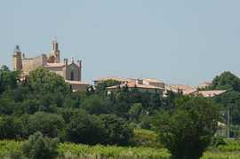
Estézargues is a commune in the Gard department in southern France.
Population
| Historical population | ||
|---|---|---|
| Year | Pop. | ±% |
| 1962 | 196 | — |
| 1968 | 200 | +2.0% |
| 1975 | 213 | +6.5% |
| 1982 | 228 | +7.0% |
| 1990 | 276 | +21.1% |
| 1999 | 384 | +39.1% |
| 2008 | 448 | +16.7% |
See also
References
| Wikimedia Commons has media related to Estézargues. |