Entebbe-Kampala Highway
| Route information | |
|---|---|
| Length: | 33 mi (53 km) |
| History: |
Designated in 2012 Completed in 2016 (Expected) |
| Major junctions | |
| South end: | Abayita Ababiri |
| North end: | Kampala Northern Bypass, Busega |
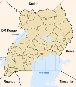
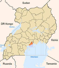
Entebbe-Kampala Highway, also known as Kampala-Entebbe Highway or Entebbe-Kampala Expressway is a four-lane toll highway under construction in Central Uganda, linking Entebbe International Airport, the country's largest civilian and military airport, to the city of Kampala (Est. 2011 pop. 1,659,600), the capital and largest metropolitan area in the country.
Location
The Entebbe-Kampala Highway will link the town of Entebbe in Wakiso District, with the city of Kampala, in Kampala District. The highway will start at Abayita Ababiri, on the existing Kampala-Entebbe Road, go through Ssisa, Kabojja, and end at Busega, where it will join the Kampala Northern Bypass Highway, a distance of approximately 37.23 kilometres (23.13 mi). A spur will branch off the highway at Kajjansi, to connect to Munyonyo, a suburb of Kampala, located on the northern shores of Lake Victoria, a distance of about 14.13 kilometres (8.78 mi). The entire highway will be a four-lane, dual carriage expressway, with limited access.[1]
Overview
Entebbe International Airport is the largest and busiest airport in Uganda. The current road, known as Kampala-Entebbe Road, is narrow, congested, and is poorly suited to handle the heavy traffic that traverses it today. In 2009, the Government of Uganda began consultations with the Government of China regarding the construction of a four-lane (dual-carriage) highway connecting Entebbe and Kampala. In November 2010, the two governments signed an agreement where the Chinese government, through the Export-Import Bank of China, would lend up to US$350 million for the construction of the highway, repayable over forty years. The design calls for a side-arm of the highway to lead from Kajjansi to Munyonyo, a prominent resort and convention suburb of Kampala, located on the northern shores of Lake Victoria.[2]
History
Construction began in 2012, with commissioning planned for 2016. The highway will be a toll-road, with vehicles that use it, requiring fittings with electronic billing devices. The contract was awarded to China Communication Construction Company, which also constructed the Soroti-Lira Road.[3] In September 2012, Uganda print media reported that construction was expected to begin in December 2012.[4]
Construction costs
The highway is estimated to cost US$476 million (UGX:1.19 trillion). Of this, US$350 million (UGX:875 billion) is a loan from the Exim Bank of China at 2% annual interest. The remaining US$176 million (UGX:315 billion) will be provided by the Government of Uganda (GOU). GOU will provide another US$40 million (UGX:100billion) to compensate land owners along the route of the highway.[5]
Developments
On Wednesday 21 November 2012, the President of Uganda, commissioned the beginning of construction of the highway at a ceremony at Kyengera, along the Kampala-Masaka Road. The highway is being constructed by China Communications Construction Company and is expected to be ready in four years.[6]
Points of interest
The following points of interest lie close or near the Entebbe-Kampala Highway:
- Entebbe International Airport, where the highway will start
- The town of Entebbe in Wakiso District
- The town of Abayita Ababiri in Wakiso District
- The town of Ssisa in Wakiso District
- The town of Kabojja in Wakiso District
- The neighborhood of Busega in Lubaga Division in the city of Kampala, where the highway will join the Kampala Northern Bypass Highway
- The neighborhood of Kajjansi, in Wakiso District, where an arm of the highway will branch off to Munyonyo, on the northern shores of Lake Victoria
- The suburb of Munyonyo in Makindye Division, in Kampala, where an arm of the highway will end.
See also
References
- ↑ Vision, Reporter (10 May 2014). "Kampala-Entebbe Highway on Track, Chinese Want to Build Railway Line". New Vision. Retrieved 11 May 2014.
- ↑ Ojambo, Fred (10 November 2009). "China To Design, Build And Manage Uganda's First Toll Highway". Bloomberg News. Retrieved 11 May 2014.
- ↑ Kafeero, Stephen (4 August 2012). "Planned Entebbe Highway Sparks Housing Boom". The Independent (Uganda). Retrieved 11 May 2014.
- ↑ Nalubega, Flavia (13 September 2012). "Entebbe Express Highway Set for December 2012". Daily Monitor. Retrieved 11 May 2014.
- ↑ Articles, . (November 2012). "The $476 Million Kampala-Entebbe Expressway Set for Construction". Afrianbuilding.com. Retrieved 11 May 2014.
- ↑ Bwambale, Taddeo (22 November 2012). "Museveni Commissions Kampala-Entebbe Road". New Vision. Retrieved 11 May 2014.
External links
- Computer Simulation of Highway Design And Traffic Patterns
- Overview of Construction Works
- Project Overview At Independent.co.ug
- Project Profile At Epcengineer.com
- Uganda Parliament Approves US$350 Loan For Toll Highway
- Details of Highway Contractual Process
- Google Map of proposed route by Suda-africa.org
| ||||||||||||||||||||||||||||||||||