Ennordres
| Ennordres | |
|---|---|
|
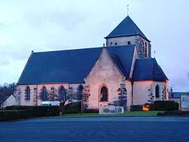
The church in Ennordres | |
 Ennordres | |
|
Location within Centre region  Ennordres | |
| Coordinates: 47°25′51″N 2°23′03″E / 47.4308°N 2.3842°ECoordinates: 47°25′51″N 2°23′03″E / 47.4308°N 2.3842°E | |
| Country | France |
| Region | Centre-Val de Loire |
| Department | Cher |
| Arrondissement | Vierzon |
| Canton | La Chapelle-d'Angillon |
| Intercommunality | Sauldre et Sologne |
| Government | |
| • Mayor (2008–2014) | Hugues Duboin |
| Area1 | 63.79 km2 (24.63 sq mi) |
| Population (2008)2 | 220 |
| • Density | 3.4/km2 (8.9/sq mi) |
| INSEE/Postal code | 18088 / 18380 |
| Elevation |
154–293 m (505–961 ft) (avg. 185 m or 607 ft) |
|
1 French Land Register data, which excludes lakes, ponds, glaciers > 1 km² (0.386 sq mi or 247 acres) and river estuaries. 2 Population without double counting: residents of multiple communes (e.g., students and military personnel) only counted once. | |
Ennordres is a commune in the Cher department in the Centre region of France.
Geography
Ennordres is made up of a rural village and associated small hamlets located among forests and farms in the valley of the Petite Sauldre river, approximately 23 miles (37 km) north of Bourges at the junction of the D171, D30 and D181 roads and on the D940 road.
Population
| Historical population | ||
|---|---|---|
| Year | Pop. | ±% |
| 1962 | 310 | — |
| 1968 | 396 | +27.7% |
| 1975 | 307 | −22.5% |
| 1982 | 589 | +91.9% |
| 1990 | 242 | −58.9% |
| 1999 | 249 | +2.9% |
| 2008 | 220 | −11.6% |
Places of interest
- The church of St. Martin, dating from the thirteenth century.
- The chateau of L'Echeneau, dating from the seventeenth century.
- The chateau of La Motte, dating from the eighteenth century.
See also
References
External links
| Wikimedia Commons has media related to Ennordres. |
- Ennordres on the Quid website (French)