Enniskillen, Ontario
[:For the unincorporated namesake community in the municipality of Clarington, see Enniskillen, Ontario (Hamlet).
| Enniskillen | |
|---|---|
| Township (lower-tier) | |
| Township of Enniskillen | |
|
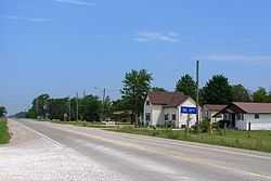
Oil City | |
 Enniskillen | |
| Coordinates: 42°49′N 82°7.5′W / 42.817°N 82.1250°WCoordinates: 42°49′N 82°7.5′W / 42.817°N 82.1250°W | |
| Country |
|
| Province |
|
| County | Lambton |
| Settled | 1830s |
| Incorporated | 1855 |
| Government | |
| • Mayor | Kevin Marriott |
| • Federal riding | Sarnia—Lambton |
| • Prov. riding | Sarnia—Lambton |
| Area[1] | |
| • Land | 338.18 km2 (130.57 sq mi) |
| Population (2011)[1] | |
| • Total | 2,930 |
| • Density | 8.7/km2 (23/sq mi) |
| Time zone | EST (UTC-5) |
| • Summer (DST) | EDT (UTC-4) |
| Postal Code FSA | N0N |
| Area code(s) | 519 and 226 |
| Website | www.enniskillen.ca |
Enniskillen is a township in the Canadian province of Ontario, within Lambton County. It is located at the intersection of Highway 21 (Oil Heritage Road) and Rokeby Line. The economy of the township is based on agriculture. It was named after Sir Galbraith Lowry Cole’s father who was the Earl of Enniskillen, Northern Ireland.
Communities
The township comprises the communities of Oil City, Glen Rae and Marthaville, and surrounds but does not include the independent municipalities of Petrolia and Oil Springs.
Demographics
| |||||||||||||||||||
Population trend:[5]
- Population in 2011: 2930
- Population in 2006: 3122
- Population in 2001: 3259
- Population in 1996: 3288
- Population in 1991: 3167
See also
References
- ↑ 1.0 1.1 "Enniskillen census profile". 2011 Census of Population. Statistics Canada. Retrieved 2012-02-09.
- ↑ "2011 Community Profiles". Canada 2011 Census. Statistics Canada. July 5, 2013. Retrieved 2012-02-09.
- ↑ "2006 Community Profiles". Canada 2006 Census. Statistics Canada. March 30, 2011. Retrieved 2011-02-22.
- ↑ "2001 Community Profiles". Canada 2001 Census. Statistics Canada. February 17, 2012. Retrieved 2011-02-22.
- ↑ Statistics Canada: 1996, 2001, 2006 census
 |
Sarnia | Plympton–Wyoming | Warwick | |
| St. Clair | |
Brooke-Alvinston | ||
| ||||
| | ||||
| Dawn-Euphemia |