Embrun, Hautes-Alpes
| Embrun | ||
|---|---|---|
|
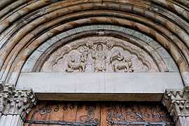
Porch of the lions | ||
| ||
 Embrun | ||
|
Location within Provence-A.-C.d'A. region 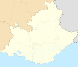 Embrun | ||
| Coordinates: 44°33′57″N 6°29′46″E / 44.5658°N 6.4961°ECoordinates: 44°33′57″N 6°29′46″E / 44.5658°N 6.4961°E | ||
| Country | France | |
| Region | Provence-Alpes-Côte d'Azur | |
| Department | Hautes-Alpes | |
| Arrondissement | Gap | |
| Canton | Embrun | |
| Intercommunality | Embrun | |
| Government | ||
| • Mayor (2008–2014) | Chantal Eyméoud (NC) | |
| Area1 | 36.39 km2 (14.05 sq mi) | |
| Population (2008)2 | 6,267 | |
| • Density | 170/km2 (450/sq mi) | |
| INSEE/Postal code | 05046 / 05200 | |
| Elevation |
778–2,800 m (2,552–9,186 ft) (avg. 871 m or 2,858 ft) | |
|
1 French Land Register data, which excludes lakes, ponds, glaciers > 1 km² (0.386 sq mi or 247 acres) and river estuaries. 2 Population without double counting: residents of multiple communes (e.g., students and military personnel) only counted once. | ||
.svg.png)
Embrun (Occitan: Ambrun, Latin: Ebrodunum, Ebrudunum,[1] and Eburodunum[1]) is a commune in the Hautes-Alpes department in the Provence-Alpes-Côte d'Azur region in southeastern France.
Description
It is located between Gap and Briançon and at the eastern end of one of the largest artificial lakes in Western Europe: the Lac de Serre-Ponçon.
The town of Embrun, Ontario was named after Embrun in 1856.
History
Embrum was formerly known as Ebrodunum (Ἐβρόδουνον in Greek language sources). There is some variation in the writing of the first part of the name. It is Epebrodunum in Strabo's text, but later translators corrected it. Strabo (iv.) says that from Tarasco to the borders of the Vocontii and the beginning of the ascent of the Alps, through the Druentia and Caballio, is 63 miles; and from thence to the other boundaries of the Vocontii, to the kingdom of Cottius (the Alpes Cottiae), to the village of Ebrodunum, 99 miles. Ebrodunum was in the country of the Caturiges, and just on the borders of the Vocontii, as it appears.
The position of Ebrodunum is easily determined by the itineraries and the name. Ptolemy (iii. 1) mentions Eborodunum as the city of the Caturiges, and no other. In the Jerusalem Itinerary Ebrodunum is called Mansio, like Caturiges (modern Chorges), which was also in the territory of the Caturiges. There are Roman remains at Chorges, and none are mentioned at Embrun, though it appears that the cathedral of Embrun is built on the site of a Roman temple, or that some of the materials of a temple were used for it.
Ebrodunum was, for a time, the capital of the Roman province of Alpes Maritimae.
In stage 17 of the 2013 Tour de France, Embrun was the starting point for an individual time trial.
Ecclesiastical history
See also
References
- ↑ 1.0 1.1 Richard Talbert, Barrington Atlas of the Greek and Roman World, (ISBN 0-691-03169-X), Map 17 and notes.
 This article incorporates text from a publication now in the public domain: Smith, William, ed. (1854–1857). "article name needed". Dictionary of Greek and Roman Geography. London: John Murray.
- This article incorporates text from a publication now in the public domain: Herbermann, Charles, ed. (1913). Catholic Encyclopedia. Robert Appleton Company. Gap
Demographic evolution

External links
| Wikimedia Commons has media related to Embrun, Hautes-Alpes. |
- (French) Embrun Office of Tourism