Elslack
Elslack is a village and civil parish in the Craven district of North Yorkshire, England, close to the border with Lancashire and 4 miles west of Skipton. Thornton in Craven is nearby. The Tempest Arms is a large pub in the village, sited by the A56, which is popular with locals from the surrounding area. Elslack Moor, above the village, is crossed by the Pennine Way, though this does not visit the village itself.
History
A Roman fort lies at 53°56′27″N 2°06′58″W / 53.94078°N 2.1160°W about 550 yards (500 m) north-west of Elslack.[1] The fort was probably named Olenacum.[2] It guarded a Roman road linking two other forts: Bremetennacum at Ribchester and another at Ilkley. This road has been traced by archaeologists running north-east up Ribblesdale about 0.6 miles (1 km) east of Clitheroe. Then at 53°53′35″N 2°20′29″W / 53.893°N 2.3413°W it turns eastwards passing Barnoldswick, Elslack and Skipton.[3]
Elslack is mentioned in the 1086 Domesday Book as Eleslac.
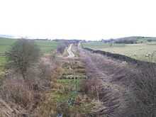
Elslack had its own railway station, but this was closed in 1952. The line passing through it suffered the same fate in 1970. The station site is now privately owned.
References
- ↑ Ordnance Survey Map OL2 Yorkshire Dales Southern and Western areas ISBN 978-0-319-24068-7
- ↑ Roman Britain.org accessed August 2012
- ↑ Ordnance Survey Map OL41 Forest of Bowland & Ribblesdale ISBN 978-0-319-24071-7
External links
![]() Media related to Elslack at Wikimedia Commons
Media related to Elslack at Wikimedia Commons
- English Heritage, National Heritage List for England – Burwen Castle Roman forts
- Pastscape – BURWEN CASTLE
Coordinates: 53°56′N 2°07′W / 53.933°N 2.117°W