Elliot, Eastern Cape
| Elliot | |
|---|---|
|
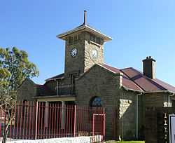
Town Hall in Elliot | |
 Elliot
| |
| Coordinates: 31°20′S 27°51′E / 31.333°S 27.850°ECoordinates: 31°20′S 27°51′E / 31.333°S 27.850°E | |
| Country | South Africa |
| Province | Eastern Cape |
| District | Chris Hani |
| Municipality | Sakhisizwe |
| Established | 1885 |
| Area[1] | |
| • Total | 28.85 km2 (11.14 sq mi) |
| Population (2011)[1] | |
| • Total | 14,376 |
| • Density | 500/km2 (1,300/sq mi) |
| Racial makeup (2011)[1] | |
| • Black African | 93.9% |
| • Coloured | 2.6% |
| • Indian/Asian | 0.4% |
| • White | 2.7% |
| • Other | 0.3% |
| First languages (2011)[1] | |
| • Xhosa | 87.1% |
| • Afrikaans | 4.5% |
| • English | 4.5% |
| • Sign language | 1.7% |
| • Other | 2.3% |
| Postal code (street) | 5460 |
| PO box | 5460 |
| Area code | 045 |
Elliot is a town in Chris Hani District Municipality in the Eastern Cape province of South Africa.
Town on the Slang River, 80 km south-west of Maclear and 65 km south-east of Barkly East.[2] It was established in 1885 and became a municipality in 1911. Named after Sir Henry George Elliot (1826-1912), Chief Magistrate of the Transkeian territories from 1891 to 1902.[3]
People born in Elliot
- Mark Andrews (rugby player)
- Os du Randt (rugby player)
References
- ↑ 1.0 1.1 1.2 1.3 "Main Place Elliot". Census 2011.
- ↑ http://www.saexplorer.co.za/south-africa/distance/elliot_distance.asp
- ↑ "Dictionary of Southern African Place Names (Public Domain)". Human Science Research Council. p. 154.
| Wikimedia Commons has media related to Elliot, Eastern Cape. |
 |
Barkly East | Tiffindell Ski Resort Rhodes |
| |
| Dordrecht, Indwe | |
Ugie, Maclear | ||
| ||||
| | ||||
| Cala |
| |||||||||||||||||||||||||||||||||||||||||
.svg.png)