Elbert, Colorado
| Elbert, Colorado | |
|---|---|
| CDP | |
| Coordinates: 39°13′12″N 104°32′12″W / 39.22000°N 104.53667°WCoordinates: 39°13′12″N 104°32′12″W / 39.22000°N 104.53667°W | |
| Country |
|
| State |
|
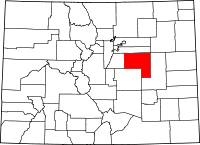
| Counties | Elbert[1] |
| Elevation[1] | 6,719 ft (2,048 m) |
| Time zone | MST (UTC-7) |
| • Summer (DST) | MDT (UTC-6) |
| ZIP code[2] | 80106 |
Elbert is a census-designated place and the location of a U.S. Post Office in Elbert County, Colorado, United States.
Geography
Elbert is located at 39°13′12″N 104°32′12″W / 39.22000°N 104.53667°W (39.220019,-104.536800).
Community
The population as of the 2010 Census was 230.[3] The community is named for a past Colorado territorial governor and state Supreme Court Justice Samuel Hitt Elbert. The Elbert Post Office has the ZIP Code 80106.[2]
Elbert was a bustling center until May 31, 1935, when Kiowa Creek, a stream next to the community, flooded suddenly and washed away half of the community. It now is the location of only a few stores, churches, and houses. The majority of Elbert residents are involved in the agriculture sector.
On June 15, 2009 at 1:46 pm, a large three quarter mile-wide, EF2 tornado touched down in rural fields west of the town. The tornado came within 2 miles of the town at its closest. The tornado destroyed a barn at a farm and damaged an airplane hangar.[4]
During the summer, Elbert is much busier due to a nearby Boy Scout Camp, Peaceful Valley Scout Ranch, which has 10,000 visitors annually. Additionally, 2.8 miles south of Elbert lies the JCC Ranch Camp, a Jewish camp owned by the Denver Jewish Community Center.
Transportation
Elbert lies along Elbert Road, which connects the town of Kiowa to U.S. Highway 24. The largest nearby city is Castle Rock, which is about 45 minutes away via SH 86, which Elbert Road crosses at Kiowa. Colorado Springs is an hour drive via US 24. From 1881 to 1936, Elbert was at mile post 52 on the Denver & New Orleans Railroad, which became the Colorado & Southern Falcon Subdivision in 1899.The railroad was rebuilt to Elbert in late 1935, only to be abandoned the following summer. Historian and author James R. "Jim" Jones chronicled the life and times of the railroad, people and places along it in his epic chronicle hardbound DENVER & NEW ORLEANS: IN THE SHADOW OF THE ROCKIES (Sundance Publications, Denver, CO. 1997). This highly valued and long out-of-print book is considered the ultimate work on the Elizabeth, Cameron and Elbert portion of Elbert County.
Elbert meteorite
On 11 January 1998 a fireball was seen over Elbert County. On 4 March 2000 a stone of 680.5 g was found in a field by the five-year-old Dustin Riffel on the property of his family. It was officially named "Elbert" and it was classified as an ordinary chondrite LL6.[5]
See also
- Outline of Colorado
- State of Colorado
- Colorado cities and towns
- Colorado census designated places
- Colorado counties
- Colorado metropolitan areas
- Front Range Urban Corridor
- North Central Colorado Urban Area
- Denver-Aurora-Boulder, CO Combined Statistical Area
- Denver-Aurora-Broomfield, CO Metropolitan Statistical Area
- Colorado cities and towns
References
- ↑ 1.0 1.1 "US Board on Geographic Names". United States Geological Survey. 2007-10-25. Retrieved 2008-01-31.
- ↑ 2.0 2.1 "ZIP Code Lookup" (JAVASCRIPT/HTML). United States Postal Service. December 27, 2006. Retrieved December 27, 2006.
- ↑ Colorado Trend Report 2: State and Complete Places (Sub-state 2010 Census Data). Missouri Census Data Center. Accessed 2011-02-25.
- ↑ http://www.thedenverchannel.com/weather/19755778/detail.html
- ↑ Meteoritical Bulletin Database: Elbert
External links
| |||||||||||||||||||||