El Palomar, Buenos Aires
| El Palomar | |
|---|---|
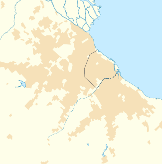 El Palomar Location in Greater Buenos Aires | |
| Coordinates: 34°37′S 58°35′W / 34.617°S 58.583°WCoordinates: 34°37′S 58°35′W / 34.617°S 58.583°W | |
| Country |
|
| Province |
|
| Partido | Morón & Tres de Febrero |
| Elevation | 6 m (20 ft) |
| Population (2001 census [INDEC]) | |
| • Total | 74,757 |
| • Density | 8,063.7/km2 (20,885/sq mi) |
| CPA Base | B 1684 |
| Area code(s) | +54 11 |
El Palomar is a district of Greater Buenos Aires in Argentina, located 20 km (12 mi) north-west of the Buenos Aires.
The city has the peculiarity of being divided between the partidos of Morón (El Palomar) and Tres de Febrero (Ciudad Jardín Lomas del Palomar). Of its 74,751 inhabitants (2001 census [INDEC]), 57,146 live within the Morón jurisdiction and 17,605 live in Tres de Febrero.
El Palomar was established with a station by that name belonging to the Buenos Aires and Pacific Railway (Spanish: Ferrocarril Buenos Aires al Pacífico) opened in 1910. Developer Publio Massini sold the first lots on November 8 of that year, and Juan Manuel Giuffra established the El Palomar Development Council, which obtained electric lighting for the area in its early years. The city is home to the National Military College (Spanish: Colegio Militar de la Nación), the 1st Air Brigade (Spanish: Primera Brigada Aérea) of the Argentine Air Force, and El Palomar Airport.
The Italian Society of Tiro al Segno (Target Shooting) (S.I.T.A.S.), is located in Palomar. Horse riding, tennis, soccer, yoga, shooting, hockey and bodybuilding among others sports can be practiced here. In an annex is the training venue for Rugby and Hockey.
French automaker PSA Peugeot Citroën has a manufacturing plant in the area, as well.
El Palomar is served by Ferrocarril General San Martín commuter rail service at El Palomar station with easy access to Retiro Station in downtown Buenos Aires, as well as by National Route 7.
Ciudad Jardín Lomas del Palomar
Inaugurated in 1944, Ciudad Jardín was conceived with the idea of creating a garden city that offered a balance of urban life with green spaces, a city within a city.
Climate
| Climate data for El Palomar, Buenos Aires, Argentina (1981-1990 period) | |||||||||||||
|---|---|---|---|---|---|---|---|---|---|---|---|---|---|
| Month | Jan | Feb | Mar | Apr | May | Jun | Jul | Aug | Sep | Oct | Nov | Dec | Year |
| Average high °C (°F) | 30.5 (86.9) |
28.6 (83.5) |
26.2 (79.2) |
22.4 (72.3) |
18.8 (65.8) |
15.4 (59.7) |
14.9 (58.8) |
17.1 (62.8) |
18.8 (65.8) |
22.2 (72) |
25.1 (77.2) |
28.1 (82.6) |
22.3 (72.1) |
| Average low °C (°F) | 18.8 (65.8) |
17.8 (64) |
15.2 (59.4) |
11.6 (52.9) |
7.8 (46) |
5.2 (41.4) |
5.0 (41) |
6.7 (44.1) |
7.8 (46) |
11.2 (52.2) |
14.3 (57.7) |
16.8 (62.2) |
11.5 (52.7) |
| Average precipitation mm (inches) | 111.2 (4.378) |
124.7 (4.909) |
127.9 (5.035) |
87.3 (3.437) |
84.5 (3.327) |
29.6 (1.165) |
46.5 (1.831) |
50.1 (1.972) |
62.7 (2.469) |
125.5 (4.941) |
120.0 (4.724) |
90.4 (3.559) |
1,147 (45.16) |
| Source: Servicio Meteorologico Nacional[1] | |||||||||||||
References
- ↑ "Weather Information for El Palomar". Retrieved 12 December 2006.
External links
| Wikimedia Commons has media related to El Palomar (Argentina). |
- ROTARY CLUB EL PALOMAR
- www.guiapalomar.com Official website (Spanish)
- Ciudad Jardín Lomas del Palomar (Spanish)