Ein Yahav
| Ein Yahav עֵין יַהַב | |
|---|---|
|
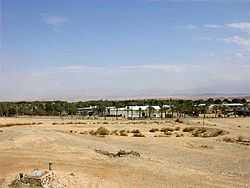
Entry to Ein Yahav. | |
 Ein Yahav | |
| Coordinates: 30°39′30.6″N 35°14′12.48″E / 30.658500°N 35.2368000°ECoordinates: 30°39′30.6″N 35°14′12.48″E / 30.658500°N 35.2368000°E | |
| District | Southern |
| Council | Central Arava |
| Affiliation | Moshav Movement |
| Founded | 1962 |
| Founded by | Veteran moshav members |
| Population (2008) | 623 |
| Name meaning | Yahav Spring |
Ein Yahav (Hebrew: עֵין יַהַב) is a moshav in Israel. Located in the northern Arava, 12 km south of Hatzeva, it falls under the jurisdiction of the Central Arava Regional Council. It is named after the Yahav Spring (in Hebrew: Ein Yahav; in Arabic: Ein Weibeh), southwest of the moshav. In 2005 it has a population of about 500.[1]
In 1950, an agricultural experimentation station was set up at Ein Yahav by members of Shahal, a movement to settle arid areas of Israel. The name was derived from the Arabic name for the area, Ayn Wiba, and the Roman name—Yahibu. The station was abandoned and on October 7, 1953, Israel Defense Forces veterans settled there.[2] In 1959 a Nahal settlement was established 5 km to the east of the original. In 1962 it was civilianized by senior moshavniks and in 1967 the settlement moved to its current location.[1] Ein-Yahav has an airfield nearby (Airport Code: EIY).[3]
There is an ancient copper-smelting site near Ein Yahav. A small hill with blackened slopes, covered mainly by crushed copper slag, identify the remains of the smelting devices used at the end of the Early Bronze Age for smelting copper.
Ein Yahav is located 100 m below sea level, between the Yahav and Nikrot streams, tributaries to the Arava Stream.[2]
References
- ↑ 1.0 1.1 Mapa's concise gazetteer of Israel. Yuval El'azari (ed.). Tel-Aviv: Mapa Publishing. 2005. p. 415. ISBN 965-7184-34-7.
- ↑ 2.0 2.1 Vilnai, Ze'ev (1978). "Ein Yahav". Ariel Encyclopedia (in Hebrew). Volume 6. Tel Aviv, Israel: Am Oved. pp. 5741–5742.
- ↑ "Information about Ein Yahav Airfield". Worldwide airport database. Retrieved 2009-03-11.
| ||||||||||