Eilean Dubh Mòr
|
Looking from Eilean Dubh Mòr over the anchorage to Eilean Dubh Beag. | |
| Location | |
|---|---|
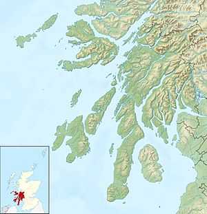 Eilean Dubh Mòr Eilean Dubh Mòr shown within Argyll and Bute | |
| OS grid reference | NM695105 |
| Names | |
| Gaelic name | Eilean Dubh Mòr |
| Meaning of name | big black island |
| Physical geography | |
| Island group | Slate Islands |
| Area | 50 hectares (124 acres)[1] |
| Area rank | 199= [2] |
| Highest elevation | 53 m |
| Political geography | |
| Sovereign state | United Kingdom |
| Country | Scotland |
| Council area | Argyll and Bute |
| Demographics | |
| Population | 0[3] |
| References | [4][5][6] |
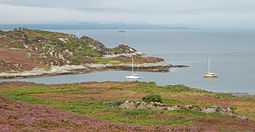
Eilean Dubh Mòr (Scottish Gaelic: big black island) is an uninhabited island in the Inner Hebrides of Scotland. It lies at the mouth of the Firth of Lorn, between the islands of Lunga and Garbh Eileach. The area of the island has been measured variously—at 50 hectares (120 acres) by Livingstone[1] and 65 hectares (160 acres) by Haswell-Smith,[4] the latter including the nearby islet of Eilean Dubh Beag (Scottish Gaelic: small black island), which is joined to Eilean Dubh Mòr at low stages of the tide.[5]
Footnotes
- ↑ 1.0 1.1 "Rick Livingstone’s Tables of the Islands of Scotland" (pdf) Argyll Yacht Charters. Retrieved 23 September 2013.
- ↑ Area and population ranks: there are c. 300 islands >20ha in extent and 93 permanently inhabited islands were listed in the 2011 census.
- ↑ National Records of Scotland (15 August 2013) (pdf) Statistical Bulletin: 2011 Census: First Results on Population and Household Estimates for Scotland - Release 1C (Part Two). "Appendix 2: Population and households on Scotland’s inhabited islands". Retrieved 17 August 2013.
- ↑ 4.0 4.1 Haswell-Smith, Hamish (2004). The Scottish Islands. Edinburgh: Canongate. ISBN 978-1-84195-454-7.
- ↑ 5.0 5.1 Ordnance Survey. Get-a-map (Map). 1:25,000. Leisure. Ordinance Survey. Retrieved 21 August 2013.
- ↑ Iain Mac an Tailleir. "Placenames" (PDF). Pàrlamaid na h-Alba. Retrieved 2007-07-28.
| ||||||||||||||||||||||||||||||||||||||||||
| ||||||||||||

Coordinates: 56°14′N 5°43′W / 56.233°N 5.717°W