Eggenfelden
| Eggenfelden | ||
|---|---|---|
|
Town square | ||
| ||
 Eggenfelden | ||
Location of Eggenfelden within Rottal-Inn district 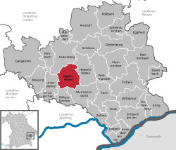 | ||
| Coordinates: 48°24′14″N 12°45′51″E / 48.40389°N 12.76417°ECoordinates: 48°24′14″N 12°45′51″E / 48.40389°N 12.76417°E | ||
| Country | Germany | |
| State | Bavaria | |
| Admin. region | Niederbayern | |
| District | Rottal-Inn | |
| Government | ||
| • Mayor | Werner Schießl (Freie Wählergruppe) | |
| Area | ||
| • Total | 44.50 km2 (17.18 sq mi) | |
| Population (2013-12-31)[1] | ||
| • Total | 13,090 | |
| • Density | 290/km2 (760/sq mi) | |
| Time zone | CET/CEST (UTC+1/+2) | |
| Postal codes | 84307 8330,8331 | |
| Dialling codes | 08721 | |
| Vehicle registration | PAN, EG, GRI, VIB | |
| Website | www.eggenfelden.de | |


Geography
Geographical location
Eggenfelden is located in the gentle valley of the Rott at the intersection of B 20 with the B 388 and the beginning of the B 588 . The city has two railway stations on the railway Passau - Neumarkt- Sankt Veit as well as an airfield (airfield Eggenfelden) . Eggenfelden is located about 56 km southeast of Landshut , 60 km south of Straubing , 70 km south-west of Passau , 84 kilometers north of Salzburg and 110 kilometers east of Munich.
Communal
The municipality Eggenfelden has 119 officially named Stadtteile:[2]
|
|
|
|
Notable people
- The ski mountaineer Konrad Lex was born in Eggenfelden.
- The German pop-singer and actor Daniel Küblböck who achieved short-lived celebrity in 2003, in the first season of Deutschland sucht den Superstar (DSDS), the German version of Pop Idol, in which he came third, was born outside of Eggenfelden and lived here until his breakthrough.
References
- ↑ "Fortschreibung des Bevölkerungsstandes". Bayerisches Landesamt für Statistik und Datenverarbeitung (in German). 31 December 2013.
- ↑ http://www.bayerische-landesbibliothek-online.de/orte/ortssuche_action.html?anzeige=voll&modus=automat&tempus=+20111129/222449&attr=OBJ&val=797
External links
![]() Media related to Eggenfelden at Wikimedia Commons
Media related to Eggenfelden at Wikimedia Commons