Eerde
| Eerde | |||||
|---|---|---|---|---|---|
| Village | |||||
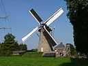
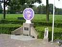
From top down, left to right: St. Anthony Abbot Church St. Anyhony Mill, Airborne monument 'Geronimo' | |||||
 Eerde | |||||
| Coordinates: 51°36′0″N 5°29′0″E / 51.60000°N 5.48333°ECoordinates: 51°36′0″N 5°29′0″E / 51.60000°N 5.48333°E | |||||
| Country | Netherlands | ||||
| Province | North Brabant | ||||
| Municipality | Veghel | ||||
| Population (2014) | 1,363 | ||||
| Time zone | CET (UTC+1) | ||||
| • Summer (DST) | CEST (UTC+2) | ||||
| Postcode | 5464 | ||||
| Area code | 0413 | ||||
| Post town | Veghel | ||||
| • BAG code | 2827 | ||||
| • Population | 30,815 | ||||
| • Density | 725/km2 (1,880/sq mi) | ||||
_church%2C_side_view.JPG)
%2C_church%2C_front_view.JPG)
St. Anthony Abbot Church in Eerde
Eerde is a village in the Dutch province of North Brabant. It is part of the municipality of Veghel, located about 3 km southwest of the town of Veghel.[1] During Operation Market Garden, in September 1944, it changed hands several times between German and American forces but ended up in American hands; the village was severely damaged in the process.
References
- ↑ ANWB Topografische Atlas Nederland, Topografische Dienst and ANWB, 2005.