Edison Bridge (Florida)
| Edison Bridge | |
|---|---|
 | |
| Coordinates | 26°39'1.97"N/ 81°52'7.82"W |
| Carries |
|
| Crosses | Caloosahatchee River |
| Locale | Fort Myers, Florida |
| Official name | Thomas A. Edison Bridge |
| Characteristics | |
| Design | Concrete Girder Bridge |
| Vertical clearance | 55 Feet |
| History | |
| Opened |
February 11, 1931 (original bridge) 1992-1993 (current bridges) |
| Statistics | |
| Toll | None |
The Edison Bridge is a bridge located in Fort Myers, Florida. The bridge is named after inventor Thomas Alva Edison, who was once a local Fort Myers resident, along with Henry Ford, founder of the Ford Motor Company. Both bridges are 55 feet tall.
The Edison Bridge consists of two separate three lane bridges, with one span carrying northbound traffic, and the other carrying southbound traffic. It carries U.S. Route 41 Business (with the hidden designation of State Road 739) over the Caloosahatchee River, connecting downtown Fort Myers (on the southern shore) with North Fort Myers. Despite carrying the same route, the two bridges are not parallel to each other. The two spans land at the same point on the north side of the river, but are separated by a few blocks on the south side. When looking on a map, the two spans and the south bank of the river form a right triangle. This is because Business Route U.S. 41 and S.R. 739 are carried on two separate one-way streets in Downtown Fort Myers, with northbound traffic using Park Avenue, and southbound traffic traveling on Fowler Street.
History
The first automobile bridge to span the Caloosahatchee River in the Fort Myers area opened on March 12, 1924. It was a narrow wooden bridge that was built by a private company and was originally intended to be a toll bridge. The bridge crossed the river in East Fort Myers at Freemont Street and connected it to what is today known as Old Bridge Road in North Fort Myers.[1] Construction of the Tamiami Trail, a roadway connecting Tampa and Miami by way of Southwest Florida, was already well underway at the time. Lee County planned to use the bridge for its portion of the Tamiami Trail, but the federal government would not designate it a federal highway if the bridge had a toll. So, the county purchased the bridge and completed its construction.[2]

The original Tamiami Trail bridge was never intended to be the Tamiami Trail's permanent crossing of the Caloosahatchee River. The structure was too narrow and passing was difficult. It was also too far east of downtown Fort Myers and a bridge across the river was needed closer to the area. A couple of locations were determined as potential sites for a permanent bridge, including Carson Street west of downtown (which would later become the location of the Caloosahatchee Bridge). But it was ultimately decided that a new bridge, which would become the original Edison Bridge, would connect Fowler Street (east of downtown) with a rerouted portion of the Tamiami Trail (U.S. Highway 41) on the north side. After the Edison Bridge opened, the original Tamiami Trail bridge remained in service as a secondary bridge until 1940, when the wooden structure was destroyed by a fire.[3]
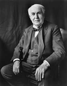
The original Edison Bridge was a low level two-lane concrete drawbridge that opened for traffic on February 11, 1931. Named for inventor Thomas Edison, the bridge opened on his 84th birthday.[4] Edison, who had a winter home in Fort Myers, dedicated the new bridge, and was also the first to drive across it after a ribbon cutting ceremony.[5]
The original Edison Bridge carried U.S. 41 from its opening in 1931 up until 1962, when the Caloosahatchee Bridge, a new four-lane high level fixed bridge, opened just downstream on the other side of downtown. U.S. 41 was rerouted onto the new structure, making it bypass downtown Fort Myers. The route over the Edison Bridge was redesignated as U.S. Route 41 Business, but is still considered as the Tamiami Trail.
The original Edison Bridge was replaced with the current dual high-level bridge spans in the early 1990s. The northbound span opened in 1992, and the southbound span opened in 1993. The current bridges are 55 feet tall, which eliminated the need for a drawbridge, and carry a combined six lanes across the river. The alignment of the two spans is similar to that of the Barron Collier Bridge and the Gilchrist Bridge, which carry U.S. 41 over the Peace River just to the north in Punta Gorda.
Gallery
-

The southbound span
-

The northbound span
-
The bridges at sunset as seen from the Riverside Park pier
References
| Wikimedia Commons has media related to Edison Bridge (Florida). |
- ↑ "Downtown Ft. Myers Waterfront". Retrieved 2011-06-08.
- ↑ Board, Prudy Taylor; Bartlett, Patricia Pope (1985). Lee County: A Pictorial History.
- ↑ "The Fort Myers Plan". The News-Press Archives. Retrieved 3 September 2014.
- ↑ "Fort Myers Landmarks and Fort Myers Monuments". Retrieved 2011-06-08.
- ↑ "THOMAS EDISON BRIDGE (Video Footage from efootage.com)". Retrieved 2011-06-08.
| ||||||||||||||||||||||||||||||||||||||||||
| |||||||||
Coordinates: 26°39′1.97″N 81°52′7.82″W / 26.6505472°N 81.8688389°W
