Edati
| Edati | |
|---|---|
| LGA | |
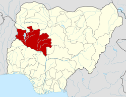
 Edati Location in Nigeria | |
| Coordinates: 9°03′N 5°39′E / 9.050°N 5.650°ECoordinates: 9°03′N 5°39′E / 9.050°N 5.650°E | |
| Country |
|
| State | Niger State |
| Area | |
| • Total | 1,752 km2 (676 sq mi) |
| Population (2006 census) | |
| • Total | 160,321 |
| Time zone | WAT (UTC+1) |
| 3-digit postal code prefix | 912 |
| ISO 3166 code | NG.NI.ED |
Edati is a Local Government Area in Niger State, Nigeria. Its headquarters are in the town of Enagi in the west of the area on the A124 highway at9°08′00″N 5°33′00″E / 9.13333°N 5.55000°E. The LGA consists of two areas, separated by the Kaduna River. It has an area of 1,752 km² and a population of 160,321 at the 2006 census.
The postal code of the area is 912.[1]
References
- ↑ "Post Offices- with map of LGA". NIPOST. Retrieved 2009-10-20.
| |||||||||||||