Eastlake, Colorado
| Eastlake, Colorado | |
|---|---|
| Unincorporated community | |
|
The Eastlake Farmers Co-Operative Elevator Company, located at 126th Avenue and Claude Court in the Eastlake Neighborhood of Thornton. | |
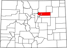
 Eastlake, Colorado Location within the state of Colorado | |
| Coordinates: 39°55′17″N 104°57′33″W / 39.92139°N 104.95917°WCoordinates: 39°55′17″N 104°57′33″W / 39.92139°N 104.95917°W | |
| Country |
|
| State |
|
| Counties | Adams[1] |
| Elevation[1] | 5,269 ft (1,606 m) |
| Time zone | MST (UTC-7) |
| • Summer (DST) | MDT (UTC-6) |
| ZIP code[2] | 80614 |

Eastlake is an unincorporated community and a U.S. Post Office in Adams County, Colorado, United States. The Eastlake Post Office has the ZIP Code 80614.[2] Numerous businesses are located in the business district of Eastlake, including; 1st Street Saloon, Appletree Dental of Eastlake, Carlson Associates, Colorado Eye Center Optometry, Eastlake Barber Shop, Eastlake Montessori School, Impact Printing, Lake Avenue Inn, Papa Mazzotti's Italian Restaurant, Lisa Anne's Cookies and Gift Shoppe, and St. Andrew's Electric. Most of the Eastlake area has been annexed by the City of Thornton.
Geography
Eastlake is located at 39°55′17″N 104°57′33″W / 39.92139°N 104.95917°W (39.921323,-104.959259).
References
- ↑ 1.0 1.1 "US Board on Geographic Names". United States Geological Survey. 2007-10-25. Retrieved 2008-01-31.
- ↑ 2.0 2.1 "ZIP Code Lookup" (JavaScript/HTML). United States Postal Service. December 15, 2006. Retrieved December 15, 2006.
External links
| |||||||||||||||||||||||||||||