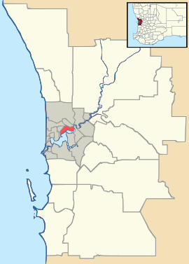
East Victoria Park, Western Australia
| East Victoria Park Perth, Western Australia | |||||||||||||
|---|---|---|---|---|---|---|---|---|---|---|---|---|---|
|
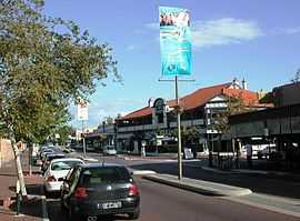
Albany Highway running through the centre of East Victoria Park | |||||||||||||
 East Victoria Park | |||||||||||||
| Coordinates | 31°59′17″S 115°54′14″E / 31.988°S 115.904°ECoordinates: 31°59′17″S 115°54′14″E / 31.988°S 115.904°E | ||||||||||||
| Population | 8,102 (2006 census)[1] | ||||||||||||
| • Density | 2,030/km2 (5,200/sq mi) | ||||||||||||
| Established | 1890s | ||||||||||||
| Postcode(s) | 6101 | ||||||||||||
| Area | 4 km2 (1.5 sq mi) | ||||||||||||
| Location | 6 km (4 mi) from Perth | ||||||||||||
| LGA(s) | Town of Victoria Park | ||||||||||||
| State electorate(s) | Victoria Park and South Perth | ||||||||||||
| Federal Division(s) | Swan | ||||||||||||
| |||||||||||||
East Victoria Park is a suburb of Perth, Western Australia, located within the Town of Victoria Park.
References
- ↑ Australian Bureau of Statistics (25 October 2007). "East Victoria Park (State Suburb)". 2006 Census QuickStats. Retrieved 2008-10-05.
