East Sparta, Ohio
| East Sparta, Ohio | |
|---|---|
| Village | |
|
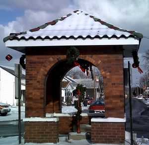
The Town Pump at Christmastime | |
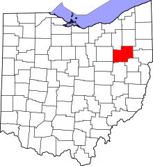
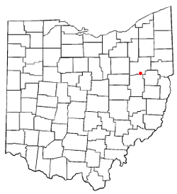 Location of East Sparta, Ohio | |
| Coordinates: 40°40′12″N 81°21′13″W / 40.67000°N 81.35361°WCoordinates: 40°40′12″N 81°21′13″W / 40.67000°N 81.35361°W | |
| Country | United States |
| State | Ohio |
| County | Stark |
| Area[1] | |
| • Total | 1.68 sq mi (4.35 km2) |
| • Land | 1.68 sq mi (4.35 km2) |
| • Water | 0 sq mi (0 km2) |
| Elevation[2] | 968 ft (295 m) |
| Population (2010)[3] | |
| • Total | 819 |
| • Estimate (2012[4]) | 813 |
| • Density | 487.5/sq mi (188.2/km2) |
| Time zone | Eastern (EST) (UTC-5) |
| • Summer (DST) | EDT (UTC-4) |
| ZIP code | 44626 |
| Area code(s) | 330 |
| FIPS code | 39-24052[5] |
| GNIS feature ID | 1061041[2] |
| Website | http://villageofeastsparta.com/ |
East Sparta is a village in Stark County, Ohio, United States. The population was 819 at the 2010 census. It is part of the Canton–Massillon Metropolitan Statistical Area. The mayor is Mike Stephens.
History
The village of Sparta was established on March 22, 1815 by Amos Janney in the southeastern part of Pike Township. Janney chose the name as the rival of Athens. The name of the village would later be changed to East Sparta because of a second village in Ohio called Sparta, Ohio. Janney built the first flour mill and sawmill. In 1819 Janney put an ad in the paper announcing a new product he called Friction Rollers. Originally founded as a trading area with a flour mill, bloomery and sawmill it later became an important manufacturing center in Stark County. The reason is that the roots of the steel production which developed in stark county in the last quarter of the 19th century go back to pioneer days and the first foundry built by Luther Drury. Abraham Cozier who opened a small store in 1820 also provided his home as the birthplace of Sparta's two churches, the Methodist and the Christian. At the opposite end of society from the churches' were the taverns which got an early start in Sparta. Philip Weaver is credited with running the first saloon in 1826. In pioneer days Pike Township had more than its share of distilleries, saloons, drinking and lawsuits, but the excess produced reaction, and Pike Township residents voted the township dry and later prided themselves on having fewer criminals and less litigation than any other township in the county.
Geography
East Sparta is located at 40°40′12″N 81°21′13″W / 40.67000°N 81.35361°W (40.669893, -81.353680),[6] along Nimishillen Creek, a short distance north of the Tuscarawas County border.[7]
According to the United States Census Bureau, the village has a total area of 1.68 square miles (4.35 km2), all land.[1]
Demographics
| Historical population | |||
|---|---|---|---|
| Census | Pop. | %± | |
| 1990 | 771 | — | |
| 2000 | 806 | 4.5% | |
| 2010 | 819 | 1.6% | |
2010 census
As of the census[3] of 2010, there were 819 people, 328 households, and 229 families residing in the village. The population density was 487.5 inhabitants per square mile (188.2/km2). There were 349 housing units at an average density of 207.7 per square mile (80.2/km2). The racial makeup of the village was 99.3% White, 0.2% African American, and 0.5% from two or more races. Hispanic or Latino of any race were 0.9% of the population.
There were 328 households of which 29.6% had children under the age of 18 living with them, 55.5% were married couples living together, 9.1% had a female householder with no husband present, 5.2% had a male householder with no wife present, and 30.2% were non-families. 24.7% of all households were made up of individuals and 12.1% had someone living alone who was 65 years of age or older. The average household size was 2.50 and the average family size was 2.95.
The median age in the village was 42.3 years. 24.3% of residents were under the age of 18; 7% were between the ages of 18 and 24; 22.4% were from 25 to 44; 28.7% were from 45 to 64; and 17.6% were 65 years of age or older. The gender makeup of the village was 49.7% male and 50.3% female.
2000 census
As of the census[5] of 2000, there were 806 people, 315 households, and 242 families residing in the village. The population density was 1,344.6 people per square mile (518.7/km²). There were 341 housing units at an average density of 568.9 per square mile (219.4/km²). The racial makeup of the village was 98.64% White, 0.25% African American, 0.37% Native American, and 0.74% from two or more races.
There were 315 households out of which 34.3% had children under the age of 18 living with them, 64.4% were married couples living together, 8.9% had a female householder with no husband present, and 22.9% were non-families. 19.7% of all households were made up of individuals and 9.8% had someone living alone who was 65 years of age or older. The average household size was 2.56 and the average family size was 2.89.
In the village the population was spread out with 24.6% under the age of 18, 6.5% from 18 to 24, 29.0% from 25 to 44, 22.1% from 45 to 64, and 17.9% who were 65 years of age or older. The median age was 39 years. For every 100 females there were 95.2 males. For every 100 females age 18 and over, there were 90.0 males.
The median income for a household in the village was $40,208, and the median income for a family was $41,964. Males had a median income of $29,267 versus $21,354 for females. The per capita income for the village was $18,017. About 4.7% of families and 5.3% of the population were below the poverty line, including 4.0% of those under age 18 and 5.7% of those age 65 or over.
References
- ↑ 1.0 1.1 "US Gazetteer files 2010". United States Census Bureau. Retrieved 2013-01-06.
- ↑ 2.0 2.1 "US Board on Geographic Names". United States Geological Survey. 2007-10-25. Retrieved 2008-01-31.
- ↑ 3.0 3.1 "American FactFinder". United States Census Bureau. Retrieved 2013-01-06.
- ↑ "Population Estimates". United States Census Bureau. Retrieved 2013-06-17.
- ↑ 5.0 5.1 "American FactFinder". United States Census Bureau. Retrieved 2008-01-31.
- ↑ "US Gazetteer files: 2010, 2000, and 1990". United States Census Bureau. 2011-02-12. Retrieved 2011-04-23.
- ↑ DeLorme (1991). Ohio Atlas & Gazetteer. Yarmouth, Maine: DeLorme. ISBN 0-89933-233-1.
| |||||||||||||||||||||||||||||||||