East Lindsey
| East Lindsey District | |
|---|---|
| Non-metropolitan district | |
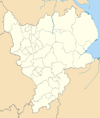
 Shown within the ceremonial county of Lincolnshire | |
| Sovereign state | United Kingdom |
| Constituent country | England |
| Region | East Midlands |
| Administrative county | Lincolnshire |
| Admin. HQ | Manby |
| Government | |
| • Type | East Lindsey District Council |
| • Leadership: | Leader & Cabinet |
| • Executive: | Conservative |
| • MPs: |
Edward Leigh, Mark Simmonds, Peter Tapsell |
| Area | |
| • Total | 680 sq mi (1,760 km2) |
| Area rank | 9th |
| Population (2011 est.) | |
| • Total | 136,700 |
| • Rank | Ranked 148th |
| • Density | 200/sq mi (78/km2) |
| Time zone | Greenwich Mean Time (UTC+0) |
| • Summer (DST) | British Summer Time (UTC+1) |
| ONS code |
32UC (ONS) E07000137 (GSS) |
| Ethnicity | 99.0% White |
| Website | e-lindsey.gov.uk |
East Lindsey is a local government district in Lincolnshire, England. The council is based in Manby near Louth. Other major settlements in the district include Alford, Spilsby, Mablethorpe, Skegness, Horncastle, a market town, and Chapel St Leonards.
Political representation
The political composition of East Lindsey District Council is as follows:
| Party | Councillors | |
|---|---|---|
| Conservatives | 28 | |
| East Lindsey Independent Group | 13 | |
| Labour | 11 | |
| District Independent/Liberal Democrat Group | 3 | |
| UKIP | 2 | |
| Independents | 2 | |
WIth 59 seats out of 60 occupied, the Conservatives are 2 seats short of a majority.[1]
Geography
East Lindsey has an area of 1,760 km², making it the fifth-largest district in England. It was formed on 1 April 1974, under the Local Government Act 1972, from the south-eastern area of the former administrative county of Lindsey. It was a merger of the municipal borough of Louth with the Alford, Horncastle, Mablethorpe and Sutton, Skegness and Woodhall Spa urban districts, and the rural districts of Horncastle, Louth and Spilsby.
It borders North East Lincolnshire and the Humber River to the north, the North Sea to the east, Boston (borough) to the south, and North Kesteven and West Lindsey to the west. The boundary between the district and North Kesteven, and part of Boston borough, is the River Witham. The furthest west settlement in the district is Wragby, and the furthest south is Anton's Gowt, near Sibsey.
It is bigger than many English counties. On the list of largest counties, it compares to the 29th largest county, being larger than counties such as Surrey, Buckinghamshire and Hertfordshire.
Economy
The coastal towns of Mablethorpe and Skegness, which attract recreational and tourist traffic, have the largest economies in the district.
Environment
East Lindsey District Council had a high rate of residential recycling; it was the UK's best performer in Defra's local authority and disposal authority 2007/8 statistics,[2] with a Household Recycling and Composting Rate of 58.4%.[3]
In 2013 councillors voted to introduce a charge to garden waste collections of £25 per year. This was met with controversy both by residents and councillors, becoming council policy by a majority of only one vote. Councillor Neil Cooper stated "The green waste charge is probably as popular as the introduction of poll tax" and in a public consultation of 1,120 respondents, 77% stated they did not wish to pay the charge.[4]
A Freedom of Information Request submitted in June 2014 confirmed significant drops in rates of green waste recycling, for the period April-May 2013 compared with April-May 2014 a drop of almost 400 tonnes was recorded; whilst at the same time an increase in domestic waste collected was recorded of over 380 tonnes.[5]
Education
East Lindsey has two of the best state schools in the East Midlands, but it also has the worst one, as judged by results. St Clements College, a secondary modern school in Skegness, got the lowest GCSEs in 2007 in the East Midlands.
References
- ↑ http://www.e-lindsey.gov.uk/Council/
- ↑ "English local authorities make good progress on recycling targets". Defra. 6 November 2008. Retrieved 4 July 2009.
- ↑ "Local Authority Municipal Waste Statistics". Defra. November 2008. Retrieved 4 July 2009.
- ↑ "Green bin fee on the way in East Lindsey to cut costs". 26 July 2013. Retrieved 11 August 2014.
- ↑ "Waste and recycling - A freedom of information request to East Lindsey District Council". 24 June 2014. Retrieved 11 August 2014.
External links
| ||||||||||||||||||||||||||||
| ||||||||||||||||||||||