Dystos
| Dystos Δύστος | |
|---|---|
 Dystos | |
|
Location within the regional unit 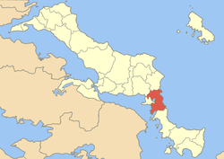 | |
| Coordinates: 38°23′N 24°7′E / 38.383°N 24.117°ECoordinates: 38°23′N 24°7′E / 38.383°N 24.117°E | |
| Country | Greece |
| Administrative region | Central Greece |
| Regional unit | Euboea |
| Municipality | Kymi-Aliveri |
| Elevation | 124 m (407 ft) |
| Population (2001)[1] | |
| • Municipal unit | 5,579 |
| Time zone | EET (UTC+2) |
| • Summer (DST) | EEST (UTC+3) |
| Postal code | 340 17, 345 00 |
| Area code(s) | 22230 |
| Vehicle registration | ΧΑ |
| Website | http://www.distos.gr/ |
Dystos (Greek: Δύστος [ˈðistos]; Latin: Dystus) is the name of a lake, village and former municipality in Euboea, Greece. Since the 2011 local government reform it is part of the municipality Kymi-Aliveri, of which it is a municipal unit.[2] The seat of the municipality was Krieza. The Dryopians were the first founders of Dystos in ancient times. During the 1950s, the power corporation of Greece established a steam power plant close to the lake at the city of Aliveri. That power plant used lake water for the cooling system. In the 1980s, the lake was filled in by debris from fires to create more land for farms. The fire lasted for a few days as tens of farmers began burning dry grass similar to the kind found in a savanna. Moreover, some of the farmers brought sheep with them and the plains contained mixed farming. Eventually in 2000, a part of the lake regenerated due to the heavy rain falls in the area. Fishing and birds are found in the lake and the area is protected by the Ramsar Convention.
Historical population
| Year | Village population | Municipality population |
|---|---|---|
| 1981 | 662 | - |
| 1991 | 589 | 5,074 |
| 2001 | 590 | 5,579 |
References
- ↑ De Facto Population of Greece Population and Housing Census of March 18th, 2001 (PDF 39 MB). National Statistical Service of Greece. 2003.
- ↑ Kallikratis law Greece Ministry of Interior (Greek)
External links
| ||||||||||||||||||||||