Duruelo de la Sierra
| Duruelo de la Sierra | |||
|---|---|---|---|
| Municipality | |||
| |||
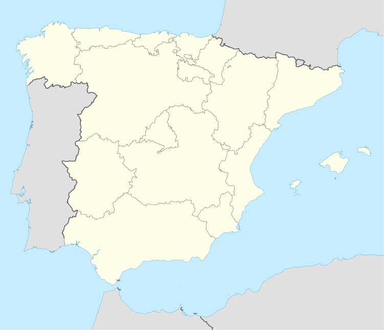 Duruelo de la Sierra Location in Spain | |||
| Coordinates: 41°57′15″N 2°55′54″W / 41.95417°N 2.93167°WCoordinates: 41°57′15″N 2°55′54″W / 41.95417°N 2.93167°W | |||
| Country |
| ||
| Autonomous community |
| ||
| Province | Soria | ||
| Comarca | Pinares | ||
| Judicial district | Soria | ||
| Government | |||
| • Alcalde | Román Martín Simón. (2007) (PP) | ||
| Area | |||
| • Total | 44.84 km2 (17.31 sq mi) | ||
| Elevation | 1,205 m (3,953 ft) | ||
| Highest elevation | 2,228.76 m (7,312.20 ft) | ||
| Population (2008) | |||
| • Total | 1,345 | ||
| • Density | 30/km2 (78/sq mi) | ||
| Demonym | Durolenses | ||
| Time zone | CET (UTC+1) | ||
| • Summer (DST) | CEST (UTC+2) | ||
| Postal code | 42158 | ||
| Official language(s) | Spanish | ||
| Website | Official website | ||
Duruelo de la Sierra is a municipality of Spain, in the province of Soria, Autonomous Community of Castile and León (Spanish Comunidad Autónoma de Castilla y León)
Population
Duruelo de la Sierra has an area of 44.55 km², with a population of 1,473 inhabitants and a density of 31.56/km².
Geography
- Altitude: 1205 metres
- Distance to Soria: 55 kilometres
Monuments and Statues
- Santa Marina Hermitage.
- San Miguel Arcángel Church (12th Century), extended 16th Century.
- Medieval Graveyard, behind San Miguel's Church. Much touristic interest, dating from the 9th to the 10th Century. (Spanish Necròpolis Medieval)
Flora y fauna
The flora of this particular region is emphasised by Scots Pine (Spanish: pino albar), accompanied by Erica vagans (Spanish: brezo), and Oak Tree (Spanish: roble).
The fauna for this particular region is emphasised by Red Deer (Spanish: ciervo), European Roe Deer (Spanish: corzo), Wild Boar (Spanish: jabalí) and Eagle (Spanish: águila).
Economy
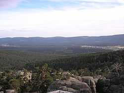
Duruelo de la Sierra and Covaleda between the pine forest, as seen from the Mirador de Castroviejo.
- Forest advantages, distribution between neighbours results in a gain of sales of the pines.
- Furniture and Wood Industry, the great industrial estate is currently expanding.
- There exists several sawmills where the pines become planks, and are sold to Spain and other countries.
Locations
- Pico de Urbión (lit. Tip of Urbión): observed from the valley, much touristic interest.
- Castroviejo: location contains unusual rock formations.
- Cueva Serena (lit. Calm Cave)
- La Chorla
- Ambas Cuerdas (lit. Both Cords)
- Fuente del berro (lit. Source of the Watercress)
- Peñas blancas (lit. White Rocks)
- Laguna de Urbión (lit. Lagoon of Urbión)
- Nacimiento del Duero (lit. Birth of Duero)
International relations
Twin towns — Sister cities
Duruelo de la Sierra is twinned with:
Fiestas y Traditions
Fiestas
- Martes de Carnaval: A Tuesday of February or March.
- Santa Marina: 17 and 18 of July.
- El Cristo: 13 to 17 of September.
Tradiciones
- La Ronda: the celebration of Martes de Carnaval and Santa Marina.
- Vaca Flaca: the celebration of Martes de Carnaval.
- La Rueda (lit. The Wheel)
- Colgar al Judas (lit. Hanging of Judas)
See also
References
- ↑ "International Relations of the City of Porto". © 2006-2009 Municipal Directorateofthe PresidencyServices InternationalRelationsOffice. Retrieved 2009-07-10.
External links
- Wikipedia Article (Spanish)
- Official Website (Spanish)