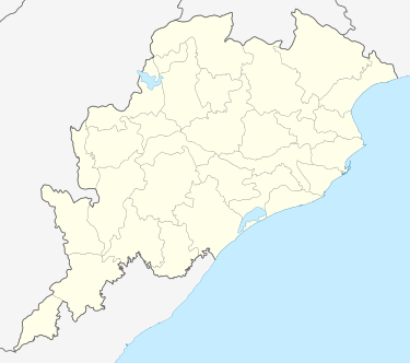
Dungamal
| Dungamal | |
|---|---|
| city | |
 Dungamal Location in Odisha, India | |
| Coordinates: 19°42′28″N 85°10′45″E / 19.7077°N 85.1793°ECoordinates: 19°42′28″N 85°10′45″E / 19.7077°N 85.1793°E | |
| Country |
|
| State | Odisha |
| District | Khordha |
| Population (2001) | |
| • Total | 6,206 |
| Languages | |
| • Official | Oriya |
| Time zone | IST (UTC+5:30) |
| PIN | 752037 |
Dungamal (Chhatragarh) (Oriya: ଡୁଂଗ ମାଳ) is a census town 7 km from Balugaon NAC (nearest railway station Chilka Rly. Station and which is last village of Chilka Block towards south. also important for Basic Training Center of India Navy (INS CHILKA). Presently new private medical opened (ABHA HOSPITAL) in Khordha district in the state of Odisha, India. In ancient time it was a fort of Khurdagarh under Banpur King BanaSur. To protect the kingdom, it was created a big canal linked to lake Chilka to Mountain Bhaleri. Now it is situated besides the village Dungamal(Chhatragarh).Near to Ava Hospital There is a Big Jagannath Temple, Guru Dwara, Beside one Masjid & Church also newly constructed here. this is small area but all India people staying due to Defence establishment INS CHILKA (Basic Training Centre of Indian Navy. This area is well connect to Bhubaneswar capital city (97 km) & Berhempur silk city (68km) to Odisha by road NH-5(Bus Stop Naval Chhaka & Rail way EcoR( Chilka station). now new Balugaon Bypass road NH-5 connected point here. This village has U.G.M.E School( Chhatragarh U.G.M.E School, Std- 1 to 8th class) under chilka Block of Khurda.
Demographics
As of 2001 census of India,[1] Dungamal had a population of 6206. Males constitute 63% of the population and females 37%. Dungamal has an average literacy rate of 83%, higher than the national average of 59.5%: male literacy is 90% and, female literacy is 70%. In Dungamal, 9% of the population is under 6 years of age.
References
- ↑ "Census of India 2001: Data from the 2001 Census, including cities, villages and towns (Provisional)". Census Commission of India. Archived from the original on 2004-06-16. Retrieved 2008-11-01.
| ||||||||||||||