Dumaran
| Dumaran | ||
|---|---|---|
| Municipality | ||
| ||
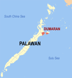 Map of Palawan with Dumaran highlighted | ||
.svg.png) Dumaran Location within the Philippines | ||
| Coordinates: 10°32′N 119°46′E / 10.533°N 119.767°ECoordinates: 10°32′N 119°46′E / 10.533°N 119.767°E | ||
| Country | Philippines | |
| Region | MIMAROPA (Region IV-B) | |
| Province | Palawan | |
| Congr. district | 1st district | |
| Barangays | 16 | |
| Government[1] | ||
| • Mayor | Medwin C. Pablico | |
| Area[2] | ||
| • Total | 435.00 km2 (167.95 sq mi) | |
| Population (2010)[3] | ||
| • Total | 21,397 | |
| • Density | 49/km2 (130/sq mi) | |
| Time zone | PST (UTC+8) | |
| Zip Code | 5310 | |
| Dialing code | 48 | |

Dumaran is a third class municipality in the province of Palawan, Philippines. According to the 2010 census, it has a population of 21,397 people.[3] The municipality covers the southern part of the namesake Dumaran Island (where the poblacion is located), as well as a portion on Palawan Island. It is bounded on the northeast by Municipality of Araceli, on the south by Sulu Sea, on the southwest by Roxas, and on the northwest by the municipality of Taytay.
Dumaran is a home for coral reefs, in fact, there is an island named Reef Island because it is where you could find a big chunk of corals beside those who encircle the whole island. This island is perfect for scuba diving and snorkeling.
In relation to its foundation day June 14, Dumaran celebrates Kalabukay Festival annually from June 14-18.
Barangays
Dumaran is politically subdivided into 16 barangays,[2] 9 barangays on the mainland of Palawan, and 7 barangays on Dumaran Island.
- Bacao (island)
- Bohol (island)
- Calasag (island)
- Capayas (mainland)
- Catep (island)
- Culasian (mainland)
- Danleg (mainland)
- Dumaran (Poblacion, island)
- Itangil (mainland)
- Ilian (mainland)
- Magsaysay (mainland)
- San Juan (island)
- Santa Teresita (mainland)
- Santo Tomas (island)
- Tanatanaon (mainland)
- Santa Maria (mainland)
Demographics
| Population census of Dumaran | ||
|---|---|---|
| Year | Pop. | ±% p.a. |
| 1990 | 12,624 | — |
| 1995 | 13,980 | +1.93% |
| 2000 | 16,616 | +3.77% |
| 2007 | 18,737 | +1.67% |
| 2010 | 21,397 | +4.95% |
| Source: National Statistics Office[3][4] | ||
Languages: Cuyonon (majority), Bisaya, Tagalog
Tourist attractions
- Dumaran Spanish Fort - located at Barangay Poblacion[5]
- Banawa Sand Bar - ideal for snorkeling for its coral reefs and rich marine life.
- Calampuan Island - known for its powdery white sand.
- Rinambacan Island - an island with white sand beach.
- Pamalatan Island - ideal for diving activities[5]
- Ilian and Santa Maria Waterfalls[5]
- San Juan and Bacao Beach
- Kalabukay Festival - annual festivity for protection of the environment especially the Katala bird ( Philippine Cockatoo). It is also the celebration of the foundation day of the municipality.
References
- ↑ "Municipalities". Quezon City, Philippines: Department of the Interior and Local Government. Retrieved 15 November 2012.
- ↑ 2.0 2.1 "Province: PALAWAN". PSGC Interactive. Makati City, Philippines: National Statistical Coordination Board. Retrieved 15 November 2012.
- ↑ 3.0 3.1 3.2 "Total Population by Province, City, Municipality and Barangay: as of May 1, 2010". 2010 Census of Population and Housing. National Statistics Office. Retrieved 15 November 2012.
- ↑ "Province of Palawan". Municipality Population Data. LWUA Research Division. Retrieved 18 July 2013.
- ↑ 5.0 5.1 5.2 "Dumaran". Provincial Government of Palawan. Retrieved 16 November 2012.
External links
- Philippine Standard Geographic Code
- Philippine Census Information
- Local Governance Performance Management System
 |
Taytay | |
Araceli | |
| |
||||
| ||||
| | ||||
| Roxas | |
Sulu Sea |
| ||||||||||||||