Drumry railway station
| Drumry | |
|---|---|
 | |
| Location | |
| Place | Clydebank |
| Local authority | West Dunbartonshire |
| Coordinates | 55°54′17″N 4°23′07″W / 55.9046°N 4.3854°WCoordinates: 55°54′17″N 4°23′07″W / 55.9046°N 4.3854°W |
| Grid reference | NS509705 |
| Operations | |
| Station code | DMY |
| Managed by | ScotRail |
| Number of platforms | 2 |
|
Live arrivals/departures, station information and onward connections from National Rail Enquiries | |
| Annual rail passenger usage* | |
| 2004/05 | 0.178 million |
| 2005/06 |
|
| 2006/07 |
|
| 2007/08 |
|
| 2008/09 |
|
| 2009/10 |
|
| 2010/11 |
|
| 2011/12 |
|
| 2012/13 |
|
| Passenger Transport Executive | |
| PTE | SPT |
| National Rail – UK railway stations | |
| * Annual estimated passenger usage based on sales of tickets in stated financial year(s) which end or originate at Drumry from Office of Rail Regulation statistics. Methodology may vary year on year. | |
| UK Railways portal | |
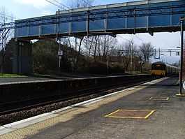
Drumry railway station serves the Drumry and Linnvale area of Clydebank, Scotland. The railway station is managed by ScotRail and is served by trains on the Argyle Line and North Clyde Line.
Drumry station was opened in 1953 to serve two of the new housing schemes that were built post World War II on the northern edges of the Burgh of Clydebank. To the north of the line is the area known as South Drumry and to the south of the line is the area of Linnvale which is bounded by the Great Weatern Road to the east, the railway line to the north and the Forth and Clyde Canal to the south.
Facilities
The station does not have a car park, but has ten cycle stands available. It is staffed from Monday to Saturday.[1]
Services
| Preceding station | |
Following station | ||
|---|---|---|---|---|
| Drumchapel | ScotRail Argyle Line |
Singer | ||
| Drumchapel | ScotRail North Clyde Line |
Singer | ||
References
Sources
- Butt, R. V. J. (1995). The Directory of Railway Stations: details every public and private passenger station, halt, platform and stopping place, past and present (1st ed.). Sparkford: Patrick Stephens Ltd. ISBN 1-8526-0508-1. OCLC 60251199.
- Jowett, Alan (March 1989). Jowett's Railway Atlas of Great Britain and Ireland: From Pre-Grouping to the Present Day (1st ed.). Sparkford: Patrick Stephens Ltd. ISBN 1-8526-0086-1. OCLC 22311137.
| Wikimedia Commons has media related to Drumry railway station. |