Driftwood Provincial Park
| Driftwood Provincial Park | |
|---|---|
|
IUCN category II (national park) | |
|
The day-use beach at Driftwood Provincial Park. | |
 | |
| Location | Ontario, Canada |
| Nearest city | Deep River, Ontario |
| Coordinates | 46°11′24″N 77°51′30″W / 46.19000°N 77.85833°WCoordinates: 46°11′24″N 77°51′30″W / 46.19000°N 77.85833°W |
| Area | 4.22 km2 (1.6 sq mi) |
| Established | 1963[1] |
| Governing body | Ontario Parks |
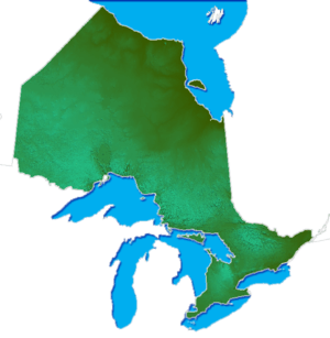
Driftwood Provincial Park is a provincial park on the south shore of the Ottawa River, about 40 kilometres (25 mi) west of Deep River, Ontario. It is administered by Ontario Parks which classifies it as a recreation park.[2]
The park is situated on a sheltered bay that was created in 1950 after the construction of the Des Joachims hydro-electric dam[3] 12 km downstream on the Ottawa River. This new bay became a spot where driftwood being carried downstream washes ashore.
This park has 80 campsites, 20 of which have electrical hookups, making it a popular summer destination for campers who can also swim at one of two sandy beaches, canoe in the Ottawa River, or hike on trails that range over eskers and rocky ridges, offering dramatic views of the Laurentian Mountains across the river in Quebec.The park is also a popular fishing destination being right on the Ottawa river, it offers yellow pickerel, northern pike and smallmouth bass. Although the park is gated in the winter, you can enter on foot for hiking, cross-country skiing and snow-shoeing.[4]
See also
- List of Canadian provincial parks - for parks in other Canadian provinces.
- List of Ontario parks
References
- ↑ "Driftwood Provincial Park - Recreation". Protected Planet. Archived from the original on 29 August 2014.
- ↑ "Driftwood". Ontario Parks. Queens Printer for Ontario. June 4, 2003. Retrieved 12 January 2012.
- ↑ "DES JOACHIMS STATION". Ottawa/St. Lawrence Group. Ontario Power Generation Inc. Retrieved 12 January 2012.
- ↑ "Park activities". Driftwood. Queen's Printer for Ontario, 2008. March 14, 2008. Retrieved 12 January 2012.
External links
| ||||||||||||||||||||||||||||
