Dracena
| Dracena | |||
|---|---|---|---|
| Municipality | |||
| The Municipality of Dracena | |||
| |||
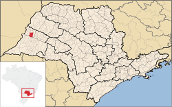 Location of Dracena | |||
| Coordinates: 21°28′57″S 51°31′58″W / 21.48250°S 51.53278°WCoordinates: 21°28′57″S 51°31′58″W / 21.48250°S 51.53278°W | |||
| Country |
| ||
| Region | Southeast | ||
| State |
| ||
| Mesoregion | Presidente Prudente | ||
| Government | |||
| • Mayor | ? | ||
| Area | |||
| • Total | 489.35 km2 (188.94 sq mi) | ||
| Elevation | 421 m (1,381 ft) | ||
| Population (2011/IBGE) | |||
| • Total | 45,914 | ||
| • Density | 83.6/km2 (217/sq mi) | ||
| Time zone | UTC-3 (UTC-3) | ||
| • Summer (DST) | UTC-2 (UTC-2) | ||
| Postal Code | 17900-000 | ||
| Area code(s) | +55(018) | ||
| Website | Prefecture of Dracena | ||


Dracena is a municipality in the state of São Paulo in Brazil. The population in 2013/ (I.B.G.E) is 45.346 and the area is 489.35 km². The elevation is 421 m.[1]
History
The foundation of Dracena occurred on December 8, 1945, when Irio Spinardi, João Vandramini, Virgílio and Florêncio Fioravanti they took an initiative to establish a core area in the forest. That day occurred a ceremony where the cornerstone was laid (after the construction of a wooden ranch-to-peak) gave the municipality.[2]
Climate
The climate is subtropical, The annual medium temperature is 23,4°C, the warmest month is January 27,8°C and the coolest month is July 17,3°C. The highest temperature ever registered was 43,1°C and the lowest, -4,1°C.
References
- ↑ "Estimativas - Contagem da População 2007". IBGE. Retrieved 2008-07-11.
- ↑ "Dracena em seu 64º aniversário no próximo dia 8 de dezembro". Prefeitura de Dracena. Retrieved 2012-04-21.