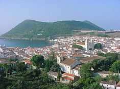
Doze Ribeiras
| Doze Ribeiras | |
| Civil Parish | |
| Official name: Freguesia das Doze Ribeiras | |
| Name origin: Portuguese for twelve streams | |
| Country | |
|---|---|
| Autonomous Region | |
| Island | Terceira |
| Municipality | Angra do Heroísmo |
| Center | Doze Ribeiras |
| - elevation | 237 m (778 ft) |
| - coordinates | 38°42′58″N 27°21′39″W / 38.71611°N 27.36083°WCoordinates: 38°42′58″N 27°21′39″W / 38.71611°N 27.36083°W |
| Highest point | Santa Bárbara |
| - elevation | 996 m (3,268 ft) |
| - coordinates | 38°44′18″N 27°19′29″W / 38.73833°N 27.32472°W |
| Lowest point | Sea Level |
| - location | Atlantic Ocean |
| Area | 10.41 km2 (4 sq mi) |
| - urban | .02 km2 (0 sq mi) |
| Population | 513 (2011) |
| Density | 49 / km2 (127 / sq mi) |
| LAU | Junta Freguesia |
| - location | Ribeira das Doze |
| - coordinates | 38°43′7″N 27°21′41″W / 38.71861°N 27.36139°W |
| President Junta | Paulo Agostinho Fagundes Cota (PS) |
| President Assembleia | Tarcísio Manuel Ávila Meneses (PS) |
| Timezone | Azores (UTC-1) |
| - summer (DST) | Azores (UTC0) |
| Postal Zone | 9700 – 339 |
| Area Code & Prefix | (+351) 292 XXX-XXXX |
| Patron Saint | São Jorge |
| Wikimedia Commons: Doze Ribeiras (Angra do Heroísmo) | |
| Geographic detail from Instituto Geográfico Português (2010) | |
Doze Ribeiras is a parish in the municipality of Angra do Heroísmo on the island of Terceira in the Azores. The population in 2011 was 513,[1] in an area of 10.41 km².[2]