Domme, Dordogne
| Domme | ||
|---|---|---|
 | ||
| ||
 Domme | ||
|
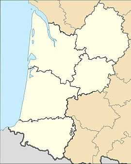
Location within Aquitaine region  Domme | ||
| Coordinates: 44°48′08″N 1°12′52″E / 44.8022°N 1.2144°ECoordinates: 44°48′08″N 1°12′52″E / 44.8022°N 1.2144°E | ||
| Country | France | |
| Region | Aquitaine | |
| Department | Dordogne | |
| Arrondissement | Sarlat-la-Canéda | |
| Canton | Domme | |
| Government | ||
| • Mayor (2008–2014) | Jocelyne Lagrange | |
| Area1 | 24.91 km2 (9.62 sq mi) | |
| Population (2008)2 | 1,004 | |
| • Density | 40/km2 (100/sq mi) | |
| INSEE/Postal code | 24152 / 24250 | |
| Elevation | 60–303 m (197–994 ft) | |
|
1 French Land Register data, which excludes lakes, ponds, glaciers > 1 km² (0.386 sq mi or 247 acres) and river estuaries. 2 Population without double counting: residents of multiple communes (e.g., students and military personnel) only counted once. | ||
Domme (Occitan: Doma) is a commune in the Dordogne department in Aquitaine in southwestern France. It is sometimes called the "Akropolis des Périgord".
Geography

Domme is 250 metres (820 ft) above sea level on a rocky outcrop overlooking the Dordogne river. With its trapezoid city plan, Domme is a bastide (a fortified medieval town) adapted to the surrounding terrain, and thus falling short of the rectangular city plan characteristic to bastides.
Today a member of the association Les Plus Beaux Villages de France ("The Most Beautiful Villages of France"), Domme has two public spaces of medieval origin: the commercial Place de la Halle ("Market Hall Square") and the Place de La Rode, where the breaking wheel entertained the public. There were two other notable locations in the village: the fair and the moneyer's house.
History
Founded as a stronghold in 1281 by Philip the Bold following his campaign along the Dordogne river, Domme obtained the privilege of minting its own currency.
In 1307, the Knight Templars were imprisoned in Domme during the trial against them, of which hundreds of Templar graffiti still bear witness. They used a code system involving series of geometric figures: the octagon represented the Grail, the triangle surmounted by a cross represented Golgatha, the square represented the Temple, and the circle represented the imprisonment. Similar inscriptions (of disputed authenticity) has been found in other towns such as Loches, Gisors, and Chinon.
During the Hundred Years' War, the bastide was coveted by the English who first took the town in 1347 and repeatedly changed rulers throughout the war until 1437 when it finally fell under French rule again.
The Wars of Religion brought new turmoil. Protestants took the city in 1588 by climbing the cliffs at night to open the gates. A short success, as the Protestant captain had to hand the bastide in which he was entrenched back to the Catholics in 1592. The city then witnessed popular revolts (Jacquerie des Croquants) in 1594 and 1637.
Domme prospered during the seventeenth century only to decline thereafter, which greatly facilitated its preservation in modern time. [1]
Population
| Historical population | ||
|---|---|---|
| Year | Pop. | ±% |
| 1962 | 855 | — |
| 1968 | 876 | +2.5% |
| 1975 | 891 | +1.7% |
| 1982 | 910 | +2.1% |
| 1990 | 1,030 | +13.2% |
| 1999 | 986 | −4.3% |
| 2008 | 1,004 | +1.8% |
See also
References
- ↑ 1.0 1.1 This section was a free translation of the French article as of June 5 2011
| Wikimedia Commons has media related to Domme. |
.svg.png)