Domérat
| Domérat | ||
|---|---|---|
|
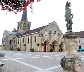
The church in Domérat | ||
| ||
 Domérat | ||
|
Location within Auvergne region  Domérat | ||
| Coordinates: 46°21′40″N 2°32′07″E / 46.3611°N 2.5353°ECoordinates: 46°21′40″N 2°32′07″E / 46.3611°N 2.5353°E | ||
| Country | France | |
| Region | Auvergne | |
| Department | Allier | |
| Arrondissement | Montluçon | |
| Canton | Domérat-Montluçon-Nord-Ouest | |
| Intercommunality | Montluçon | |
| Government | ||
| • Mayor (2008–2014) | Marc Malbet | |
| Area1 | 35.54 km2 (13.72 sq mi) | |
| Population (2008)2 | 9,004 | |
| • Density | 250/km2 (660/sq mi) | |
| INSEE/Postal code | 03101 / 03410 | |
| Elevation |
197–376 m (646–1,234 ft) (avg. 243 m or 797 ft) | |
|
1 French Land Register data, which excludes lakes, ponds, glaciers > 1 km² (0.386 sq mi or 247 acres) and river estuaries. 2 Population without double counting: residents of multiple communes (e.g., students and military personnel) only counted once. | ||
.svg.png)
Domérat is a commune in the Allier department in central France.
Population
| Historical population | ||
|---|---|---|
| Year | Pop. | ±% |
| 1793 | 1,810 | — |
| 1800 | 1,456 | −19.6% |
| 1806 | 1,367 | −6.1% |
| 1821 | 2,113 | +54.6% |
| 1831 | 2,812 | +33.1% |
| 1836 | 3,006 | +6.9% |
| 1841 | 3,022 | +0.5% |
| 1846 | 3,169 | +4.9% |
| 1851 | 3,130 | −1.2% |
| 1856 | 3,129 | −0.0% |
| 1861 | 3,221 | +2.9% |
| 1866 | 3,438 | +6.7% |
| 1872 | 3,524 | +2.5% |
| 1876 | 3,506 | −0.5% |
| 1881 | 3,554 | +1.4% |
| 1886 | 3,657 | +2.9% |
| 1891 | 3,616 | −1.1% |
| 1896 | 3,513 | −2.8% |
| 1901 | 3,353 | −4.6% |
| 1906 | 3,535 | +5.4% |
| 1911 | 3,147 | −11.0% |
| 1921 | 2,830 | −10.1% |
| 1926 | 2,831 | +0.0% |
| 1931 | 3,044 | +7.5% |
| 1936 | 3,019 | −0.8% |
| 1946 | 4,177 | +38.4% |
| 1954 | 5,072 | +21.4% |
| 1962 | 5,685 | +12.1% |
| 1968 | 5,725 | +0.7% |
| 1975 | 7,139 | +24.7% |
| 1982 | 8,534 | +19.5% |
| 1990 | 8,875 | +4.0% |
| 1999 | 8,809 | −0.7% |
| 2008 | 9,004 | +2.2% |
See also
References
| Wikimedia Commons has media related to Domérat. |