Dolane
| Dolane | |
|---|---|
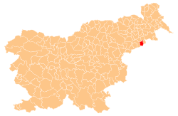
_location_map.svg.png) Dolane Location in Slovenia | |
| Coordinates: 46°21′50.28″N 15°59′58.38″E / 46.3639667°N 15.9995500°ECoordinates: 46°21′50.28″N 15°59′58.38″E / 46.3639667°N 15.9995500°E | |
| Country |
|
| Traditional region | Styria |
| Statistical region | Drava |
| Municipality | Cirkulane |
| Area | |
| • Total | 2.34 km2 (0.90 sq mi) |
| Elevation | 212.7 m (697.8 ft) |
| Population (2002) | |
| • Total | 156 |
| [1] | |
Dolane (pronounced [dɔˈlaːnɛ]) is a settlement on the right bank of the Drava River in the Municipality of Cirkulane in the Haloze area of eastern Slovenia. The area traditionally belonged to the Styria region. It is now included in the Drava Statistical Region.[2]
Borl Castle (German: Ankenstein)[3][4] is an imposing medieval castle above the banks of the Drava north of the main settlement. It dates to the 13th century with 15th- and 17th-century additions. Some wall paintings, sculpture, and internal furnishings survive. In the Second World War, between 1941 and 1943, the castle served as a Gestapo prison. At first the castle stables and later the castle itself were used to imprison, interrogate, and torture suspects. In 1956 a memorial room was opened and a commemorative plaque was unveiled at the castle.[5]
References
- ↑ Statistical Office of the Republic of Slovenia
- ↑ Cirkulane municipal site
- ↑ Jakič, Ivan. 1997. Vsi slovenski gradovi: leksikon slovenske grajske zapuščine. Ljubljana: DZS, p. 62.
- ↑ Kos, Dušan. 1994. Med gradom in mestom. Ljubljaba: ZRC, p. 61.
- ↑ Slovenian Ministry of Culture register of national heritage reference numbers 35 & 6659
External links
| ||||||||||||