Doi Tao District
| Doi Tao ดอยเต่า | |
|---|---|
| Amphoe | |
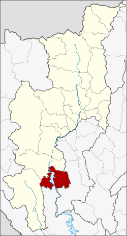 Amphoe location in Chiang Mai Province | |
| Coordinates: 17°57′13″N 98°41′6″E / 17.95361°N 98.68500°ECoordinates: 17°57′13″N 98°41′6″E / 17.95361°N 98.68500°E | |
| Country |
|
| Province | Chiang Mai |
| Seat | Tha Duea |
| Area | |
| • Total | 803.9 km2 (310.4 sq mi) |
| Population (2005) | |
| • Total | 27,284 |
| • Density | 33.9/km2 (88/sq mi) |
| Time zone | THA (UTC+7) |
| Postal code | 50260 |
| Geocode | 5017 |
Doi Tao (Thai: ดอยเต่า) is a district (amphoe) in the southern part of Chiang Mai Province in northern Thailand.
Geography
Neighboring districts are (from the west clockwise) Om Koi, Hot of Chiang Mai Province, Li of Lamphun Province and Sam Ngao of Tak Province.
The southern end of the Khun Tan Range reaches the eastern side of this district.
History
The minor district (King Amphoe) was established on October 16, 1972 by splitting off the four tambon Tha Duea, Doi Tao, Muet Ka and Ban Aen from Hot district.[1] It was upgraded to a full district on March 25, 1979.[2]
Administration
The district is subdivided into 6 subdistricts (tambon), which are further subdivided into 42 villages (muban). Tha Duea is a township (thesaban tambon) which covers parts of the tambon Tha Duea and Mueat Ka. There are further 5 Tambon administrative organizations (TAO).
| No. | Name | Thai name | Villages | Inh. | |
|---|---|---|---|---|---|
| 1. | Doi Tao | ดอยเต่า | 10 | 6,790 | |
| 2. | Tha Duea | ท่าเดื่อ | 6 | 3,242 | |
| 3. | Muet Ka | มืดกา | 5 | 3,363 | |
| 4. | Ban Aen | บ้านแอ่น | 4 | 2,804 | |
| 5. | Bong Tan | บงตัน | 6 | 4,678 | |
| 6. | Pong Thung | โปงทุ่ง | 11 | 6,407 |
References
- ↑ ประกาศกระทรวงมหาดไทย เรื่อง แบ่งท้องที่อำเภอฮอด จังหวัดเชียงใหม่ ตั้งเป็นกิ่งอำเภอดอยเต่า. Royal Gazette (in Thai) 89 (155 ง): 2598. October 17, 1972.
- ↑ พระราชกฤษฎีกาตั้งอำเภอหนองกุงศรี อำเภอไทรงาม อำเภอบ้านฝาง อำเภออุบลรัตน์ อำเภอเวียงชัย อำเภอดอยเต่า อำเภอนิคมคำสร้อย อำเภอนาหว้า อำเภอเสิงสาง อำเภอศรีสาคร อำเภอบึงสามพัน อำเภอนาดูน อำเภอค้อวัง อำเภอโพธิ์ชัย อำเภอเมืองสรวง อำเภอปลวกแดง อำเภอยางชุมน้อย อำเภอกาบเชิง อำเภอสุวรรณคูหา และอำเภอกุดข้าวปุ้น พ.ศ. ๒๕๒๒. Royal Gazette (in Thai) 96 (42 ก Special): 19–24. March 25, 1979.
External links
| ||||||