Dogana
| Dogana | |
|---|---|
| Town and Civil Parish | |
|
Entry point into the Republic of San Marino in Dogana | |
 Location of Dogana within San Marino | |
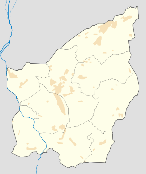 Dogana Location within San Marino | |
| Coordinates: 43°58′52.57″N 12°29′22.2″E / 43.9812694°N 12.489500°E | |
| Country |
|
| Municipality |
|
| Elevation | 150 m (490 ft) |
| Population | |
| • Total | 7,000 |
| Demonym | doganieri |
| Time zone | CET (UTC+1) |
| • Summer (DST) | CEST (UTC+2) |
| Postal code | 47891 |
| Area code(s) | +378 (0549) |

Dogana is a town and a civil parish (curazia) in the north-eastern corner of San Marino in the Serravalle municipality (castle). The town is the most populated settlement in the republic.[1]
Geography
The town is situated at the northernmost point of San Marino after Falciano, close to the border with Italy (at Cerasolo Ausa, a frazione of Coriano, in the province of Rimini).
History
It has a population of roughly 7,000. Due to its size, in 2006 it has asked to split away from Serravalle and become its own castello, but in 2007 the proposal was refused.[1] A partial autonomy is reflected in Dogana's having its own postal code (47891), while the rest of Serravalle carries the designation 47899.
Economy
Dogana is the main entry point for travellers arriving into San Marino from Italy (by freeway no. 72 from Rimini). Although Dogana means customs house in Italian, there are no border formalities anywhere on the border between Italy and San Marino, so the motorists may stop in Dogana only to shop at one of its shopping malls.
Sport
The local football team is the Juvenes.
Gallery
-

Borders between Italy and San Marino at Dogana
-
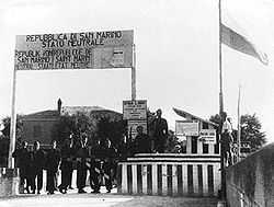
Neutrality placards at the borders of San Marino during World War II ("Republic of San Marino - Neutral State")
See also
- Stadio Olimpico (San Marino)
- Serravalle
- Cà Ragni
- Cinque Vie
- Falciano
- Lesignano
- Ponte Mellini
- Rovereta
- Valgiurata
References
- ↑ 1.0 1.1 (Italian) Serravalle and Dogana at sanmarinosite.com
External links
![]() Media related to Dogana at Wikimedia Commons
Media related to Dogana at Wikimedia Commons
| ||||||||||||||||||||||||||||||||||||||||