Dodoni
| Dodoni Δωδώνη | |
|---|---|
|
View of Dodoni and mount Tomaros | |
 Dodoni | |
|
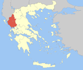
Location within the region  | |
| Coordinates: 39°33′N 20°46′E / 39.550°N 20.767°ECoordinates: 39°33′N 20°46′E / 39.550°N 20.767°E | |
| Country | Greece |
| Administrative region | Epirus |
| Regional unit | Ioannina |
| Area | |
| • Municipality | 663.0 km2 (256.0 sq mi) |
| • Municipal unit | 101.0 km2 (39.0 sq mi) |
| Population (2011)[1] | |
| • Municipality | 9,693 |
| • Municipality density | 15/km2 (38/sq mi) |
| • Municipal unit | 1,338 |
| • Municipal unit density | 13/km2 (34/sq mi) |
| Time zone | EET (UTC+2) |
| • Summer (DST) | EEST (UTC+3) |
| Vehicle registration | ΙΝ |

Dodoni (Greek: Δωδώνη) is a village and a municipality in the Ioannina regional unit, Epirus, Greece. The seat of the municipality is the village Agia Kyriaki.[2] Dodoni is located near the site of the ancient oracle of Dodona. Oedipus the King was shot here in 1967.
Municipality
The present municipality Dodoni was formed at the 2011 local government reform by the merger of the following 4 former municipalities, that became municipal units:[2]
- Agios Dimitrios
- Dodoni
- Lakka Souliou
- Selles
Gallery
-

Theatre at Dodoni
-

View on theatre and mount Tomaros
-
Dodoni municipality
References
- ↑ "Detailed census results 2011" (in Greek).
- ↑ 2.0 2.1 Kallikratis law Greece Ministry of Interior (Greek)
| ||||||||||||||||||||||||||||||
| ||||||||||||||||||