Diorios
| Dhiorios or Diorios | |
|---|---|
| Διόριος (Greek) Tepebaşı (Turkish) | |
 Dhiorios or Diorios Location in Cyprus | |
| Coordinates: 35°18′20″N 33°3′15″E / 35.30556°N 33.05417°ECoordinates: 35°18′20″N 33°3′15″E / 35.30556°N 33.05417°E | |
| Country |
de jure |
| District |
de jure Kyrenia District |
| Population (2011)[1] | |
| • Total | 798 |
| Time zone | EET (UTC+2) |
| • Summer (DST) | EEST (UTC+3) |
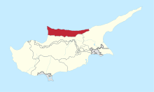
Dhiorios or Diorios (Greek: Διόριος, Turkish: Tepebaşı) is a village in Northern Cyprus, 2 km west of Myrtou.
Name Origin
For its name various versions exist that have stood the test of time. One of them claims that it took its name from the two kingdoms that existed in the region. Another version is because it faces two hills (mountains).[2] A third version notes that owes its name from two streams that flowed to the ground, while a fourth says it was so named because it was in ancient times, the hill of the father of the Olympian Gods, Zeus.Whichever the version one thing is certain: that Dhiorios is a very beautiful and enchanting village of Kyrenia.
Location
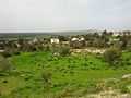
Located in a magnificent natural setting on the south side of the plateau of Myrtou, in dense forests that spread throughout the village and joined by a magical way with the sea of Agia Eirini all the way up to Kormakitis.
Diorios was a mixed village (Greek Cypriots and Turkish Cypriots) which has excellent views of the Bay of Morphou, the mountain of old Epia, the port of Xeros and ancient Solon.
After the hostilities in 1974,[3] population transfers were made in accordance with the population exchange agreement between Turkish and Greek Cypriots (Third Vienna Agreement) under the auspices of United Nations on 2 August 1975; [4] the Greek Cypriots in Diorios moved to the south. In response, the Turkish Cypriots in the south of the island moved to the north, some of which located to Diorios.
Dhiorios is known to date for the unique, red tulips . The vegetation of the Cyprus tulip «Tulipa Cypria» or "laledes " by the locals, where flourish in abundant quantities during the months of March and April, is characteristic of the region.
From a geological point of view, the administrative area of the village is dominated by sandstones, flysch of Kythrea and to a lesser extent, alluvial deposits, especially along the river basins of the region. On the deposits, were developed xerorentzines and territories terraroza . The average annual rainfall in the village area is reached by the homonymous state forest. In the remaining areas were before the hostilities of 1974[3] mainly cereals, carob and olive trees.
Diorios' population increased from 1881 until 1946. In 1881 the inhabitants numbered 387 and increased to 432 in 1891. In 1911 the inhabitants were 614 (402 Greeks and 212 Turks), while in 1946 amounted to 795 ( 517 Greeks, 271 Turks and 7 others). In the next census in 1956, a decrease of inhabitants numbered 622 (374 Greeks, 246 Turks and 2 others). Later there was increasing again in 1960 the villagers were 873 (514 Greeks and 359 Turks ) . The Turkish villagers abandoned it in 1964, because of the hostilities between Greek Cypriots and Turkish Cypriots. In 1973, the Greek population of the village numbered 600 inhabitants. Greek Cypriots were only 16 people in October 1975.
The village church dedicated to Agia Marina, was built in 1850 over an older church. In 1973 worked the new church of St. Marina in another village location. The old church was damaged during the hostilities of 1974 and is in ruins till now, the newer temple located in a military area said was used as a hospital. Other chapels of the village is St. John, Prophet Zachariah, St. Black, Prophet Elias, Archangel Michael, St. George ( Mahania forest area), St. George (Trimithias area) of the Holy Cross, and Agiopetras St. Nicholas.
More info about the village
-
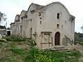
A Front picture of Agia Marina church in Diorios Village
-
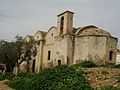
A back picture of Agia Marina church in Diorios Village
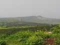
-
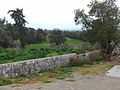
A view of Morfou gulf on a foggy day
-
A view of Kormakitis from Diorios
-
A view of Kormakitis from Diorios
Dhiorios is the second larger administrative area in the village of Kyrenia (the largest is Kormakitis).[2] Its administrative limits reach to the southern border of the Nicosia-Kyrenia.
Most of the administrative area of the village is covered by a dense pine forest, while in other areas the villagers cultivate mainly cereals, carob and olive trees.[2] Dhiorios forest occupies an area of 8,400 acres, i.e. 1,124.4 hectares and the village covers an area of 27,587 acres or 36.9 square miles.
New emblem for Dhiorios
In 2012, the Community Council-in-exile created an emblem to reflect the identity of the village. After considering the church of Agia Marina, the area's unique tulips and the village square, the community chose tulips as the preferred symbol. The emblem includes three major elements and combinations of colors: the tulips that flourish in the village and the colors green and blue, which represent areas of the village and characteristics of people who lived there. The green color symbolizes the forest of Dhiorios and fertile grounds of the entire region, while the blue color symbolizes the endless view of the sea and the blue horizon. The combination of these colors symbolizes the peace and tranquility of the area. The Community Council-in-exile aims to pass the message that how many years will go by we will remember our village and continue the struggle for a peaceful resolution based on the Purposes and Principles of the United Nations.
External links
- "Kyrenia Municipality" (in Greek).
References
- ↑ KKTC 2011 Nüfus ve Konut Sayımı [TRNC 2011 Population and Housing Census] (PDF), TRNC State Planning Organization, 6 August 2013
- ↑ 2.0 2.1 2.2 Διόριος [Diorios] (in Greek). Ένωσης Κοινοτήτων Επαρχίας Κερύνειας [Kyrenia District Communities Union].
- ↑ 3.0 3.1 UN official website UNFICYP Mandate
- ↑ United Nations, Cyprus Population Exchange Agreement 02.08.1975 United Nations, Cyprus Population Exchange Agreement 2 August 1975.